


![Image [2]-Unlocking the Depths: 5 Critical Applications of Underwater Drones from Ocean Research to Offshore Wind Farms-msoen](https://www.msoen.com/wp-content/uploads/2026/02/5096d44e7508.jpg)
![Image [4]-Unlocking the Depths: 5 Critical Applications of Underwater Drones from Ocean Research to Offshore Wind Farms-msoen](https://www.msoen.com/wp-content/uploads/2026/02/15908acfb89a.jpeg)

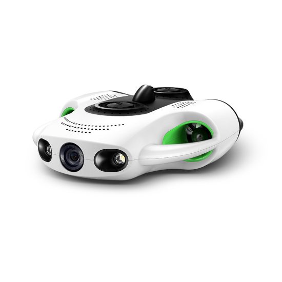
The silent revolution beneath the waves is powered by underwater drones—autonomous or remotely operated vehicles (AUVs/ROVs) transforming how we interact with the ocean’s final frontier. Far beyond recreational gadgets, these sophisticated machines are becoming indispensable tools across scientific, industrial, and defense sectors. This comprehensive guide explores five pivotal applications, backed by technical insights and real-world impact, demonstrating why underwater drones represent a quantum leap in marine technology.
Application 1: Marine Scientific Research & Ecosystem Monitoring
Underwater drones provide unprecedented access to study delicate marine ecosystems without disturbing habitats. Equipped with high-resolution cameras, CTD sensors (Conductivity, Temperature, Depth), and acoustic Doppler current profilers (ADCPs), they map coral reefs, track migratory patterns, and monitor water quality parameters in real-time.
Case Study: Researchers at Scripps Institution of Oceanography deployed an AUV to survey kelp forest health off California’s coast. The drone’s hyperspectral imaging identified stress indicators invisible to satellites, enabling targeted conservation efforts.
Technical Edge:
- Multibeam Echosounders: Generate detailed bathymetric maps (resolution down to 5cm).
- Environmental DNA (eDNA) Samplers: Collect genetic material from water columns to identify species presence.
- Long-Endurance AUVs: Operate for 24+ hours, covering 100km+ per mission.
Application 2: Offshore Wind Turbine Inspection & Maintenance
Routine inspections of offshore wind turbines are critical for operational efficiency and safety. Traditional methods using human divers are limited by depth, weather, and risk. Underwater drones now perform non-destructive testing (NDT) on foundations, monopiles, and subsea cabling.
Key Capabilities:
- Cathodic Protection Surveys: Measure potential differences to prevent corrosion.
- Anomaly Detection: Use 4K/HD cameras and laser scanners to identify micro-cracks (>0.1mm).
- Debris Clearance: Robotic arms remove biofouling or obstructions.
ROI Impact: A single drone can inspect 10 turbines in a day versus 2-3 days for dive teams, reducing downtime by 40%.
Application 3: Subsea Infrastructure Integrity Management
Oil & gas pipelines, telecommunications cables, and aqueducts require constant monitoring. Underwater drones detect leaks, scour erosion, and third-party interference with minimal disruption.
Innovative Tools:
- Synthetic Aperture Sonar (SAS): Penetrates sediment to reveal buried infrastructure.
- Magnetometers: Detect ferrous metal anomalies indicating structural damage.
- ROV-Operated UT Flaw Detectors: Perform ultrasonic thickness measurements on pipelines.
Example: Equinor uses work-class ROVs to inspect North Sea oil rigs, cutting inspection costs by €2M annually.
Application 4: Search & Recovery (SAR) Operations
From locating downed aircraft to retrieving lost cargo, underwater drones accelerate SAR missions. Side-scan sonar and multibeam systems create 3D models of wreckage sites, while manipulator arms recover objects.
Performance Metrics:
- Search Speed: Cover 1km² in 2 hours (vs. 8+ hours for human divers).
- Depth Rating: Up to 6,000m (e.g., Saab Seaeye Falcon).
- Object Recognition AI: Identifies targets with 95% accuracy.
Notable Use: In 2022, a Bluefin AUV located a WWII fighter plane in the Pacific at 1,200m depth in 18 hours.
Application 5: Aquaculture & Fisheries Management
Underwater drones optimize fish farm operations by monitoring stock health, net integrity, and environmental conditions. They count biomass, assess feeding behavior, and detect disease signs like skin lesions.
Technological Integration:
- Dissolved Oxygen Sensors: Prevent hypoxia events.
- Bioluminescence Cameras: Track zooplankton movements affecting feed distribution.
- Autonomous Feeding Systems: Dispense food based on real-time fish density data.
Efficiency Gain: Salmon farms using drones report 15% higher survival rates and 20% lower feed waste.
Technical Specifications Comparison
| Parameter | AquaXplorer 5000 (AUV) | SeaWing Pro (ROV) | DeepGuard 300 (Hybrid) |
|---|---|---|---|
| Max Depth | 1,500m | 3,000m | 6,000m |
| Endurance | 30 hrs | 8 hrs (tethered) | 24 hrs (AUV mode) |
| Payload Capacity | 10kg | 25kg | 15kg |
| Propulsion | Electric thrusters | Hydraulic manipulators | Hybrid (Electric/Hydraulic) |
| Sensors | CTD, ADCP, eDNA sampler | HD Camera, UT flaw detector | SAS, Magnetometer, LiDAR |
| Price Range | $250K–$400K | $500K–$1.2M | $800K–$1.5M |
AUV vs. ROV vs. Hybrid: Which to Choose?
- AUVs (Autonomous Underwater Vehicles): Ideal for large-scale surveys (e.g., mapping 500km² of seabed). Pros: No tether, long endurance. Cons: Limited real-time control.
- ROVs (Remotely Operated Vehicles): Suited for precision tasks (e.g., valve manipulation). Pros: Direct operator input, heavy payloads. Cons: Tether management, shorter range.
- Hybrid Systems: Combine AUV transit with ROV operation. Example: Deploying as an AUV to a site, then switching to ROV mode for close-up work.
“For offshore wind inspections, we use ROVs for their dexterity in tight spaces, but AUVs for pre-mission area scanning.” – Dr. Lena Schmidt, Offshore Robotics Institute.
FAQs: Underwater Drones Demystified
Q1: How do underwater drones handle pressure at extreme depths?
A: They use syntactic foam buoyancy and titanium housings rated to specific pressures (e.g., 6,000m = 600 bar).
Q2: Can drones operate in strong currents?
A: Yes, advanced models use vector thrusters and dynamic positioning (DP) to maintain position in currents up to 2 knots.
Q3: What’s the difference between sonar and LiDAR for underwater use?
A: Sonar uses sound waves (works in murky water), while LiDAR uses light (higher resolution but limited to clear water <50m).
Q4: How are underwater drones powered?
A: Lithium-ion batteries (AUVs) or surface power via umbilical cable (ROVs).
Q5: Are they safe for marine life?
A: Yes, low-noise electric motors and non-invasive sensors minimize disturbance.
Q6: How accurate are underwater GPS systems?
A: None exist underwater. Positioning relies on dead reckoning, USBL (Ultra-Short Baseline), or LBL (Long Baseline) acoustic beacons.
Q7: What training is required to operate one?
A: 2-4 week certification programs cover piloting, mission planning, and maintenance.
Q8: How do they communicate underwater?
A: Acoustic modems (low bandwidth) or fiber-optic tethers (ROVs).
The Future Is Below
As battery tech improves and AI enables swarming capabilities, underwater drones will become more autonomous and cost-effective. Innovations like hydrogen fuel cells could extend AUV endurance to weeks, while soft robotics may allow gentler interaction with fragile corals. For industries from energy to ecology, mastering the subsurface domain is no longer optional—it’s a competitive imperative.
“We’re moving from ‘seeing’ the ocean to ‘understanding’ it. Drones are the stethoscopes for planet Earth’s last great wilderness.” – Dr. Robert Ballard, Oceanographer.
By integrating cutting-edge hardware with mission-specific software, underwater drones are not just tools—they are extensions of human capability, turning the once-inaccessible deep into a new frontier for discovery and industry.


No comments yet