




Introduction
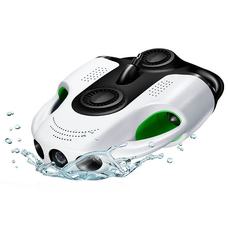
Beneath the shimmering surface of oceans, lakes, and rivers lie silent witnesses to human history—shipwrecks that have slumbered for centuries, their wooden hulls softened by time, their cargoes buried in sediment, and their stories waiting to be rediscovered. For decades, archaeologists have relied on scuba divers, remotely operated vehicles (ROVs), and sonar systems to explore these underwater time capsules. However, traditional methods often face limitations: divers are restricted by depth and time, while conventional ROVs can be bulky, expensive, and less agile in tight spaces. Enter the MSOEN underwater drone—a revolutionary tool designed to transform how we study submerged cultural heritage, offering unprecedented precision, efficiency, and non-invasiveness. This article delves into the technology behind the MSOEN drone, its application in restoring the structure of a 1,000-year-old shipwreck, and the broader implications for archaeological research.
The Challenge of Underwater Archaeology
Underwater archaeology is a field defined by challenges. Water’s opacity obscures visibility, pressure increases with depth, and currents can disrupt delicate sites. Traditional tools like side-scan sonar provide broad overviews but lack the detail needed to map small artifacts or structural features. Human divers, though skilled, are limited to shallow depths (typically under 40 meters) and short working times, making large-scale exploration inefficient. Even advanced ROVs, while capable of deeper dives, often require large support vessels and complex operation, limiting their use in remote or environmentally sensitive areas.
For a millennium-old shipwreck, these challenges are magnified. Such wrecks are fragile; even minor disturbances can cause irreversible damage. Moreover, their structures—decayed wood, corroded metal, and sediment-encrusted remains—require high-resolution imaging to distinguish between original components and post-depositional changes. Without precise data, reconstructing the ship’s design, purpose, and historical context becomes nearly impossible.
The MSOEN Underwater Drone: Technology Tailored for Archaeology
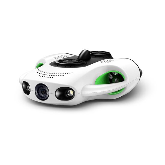
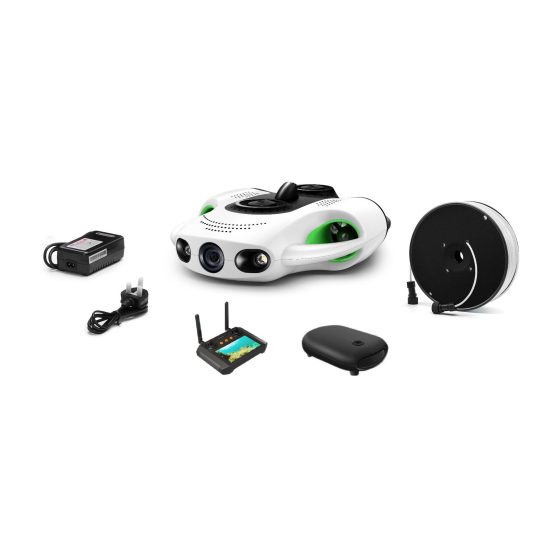
The MSOEN underwater drone was developed to address these challenges, combining cutting-edge engineering with a deep understanding of archaeological needs. Unlike generic consumer drones adapted for water, the MSOEN is purpose-built, with features optimized for low-impact exploration and detailed data collection.
Core Design Principles
-
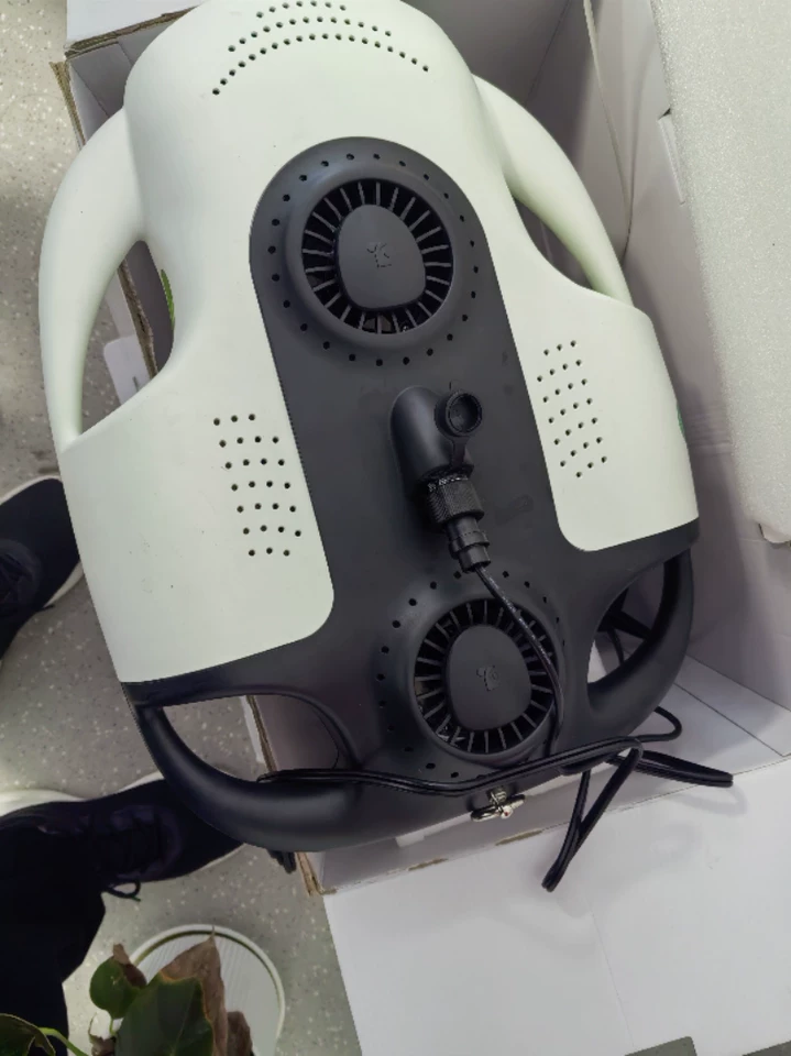
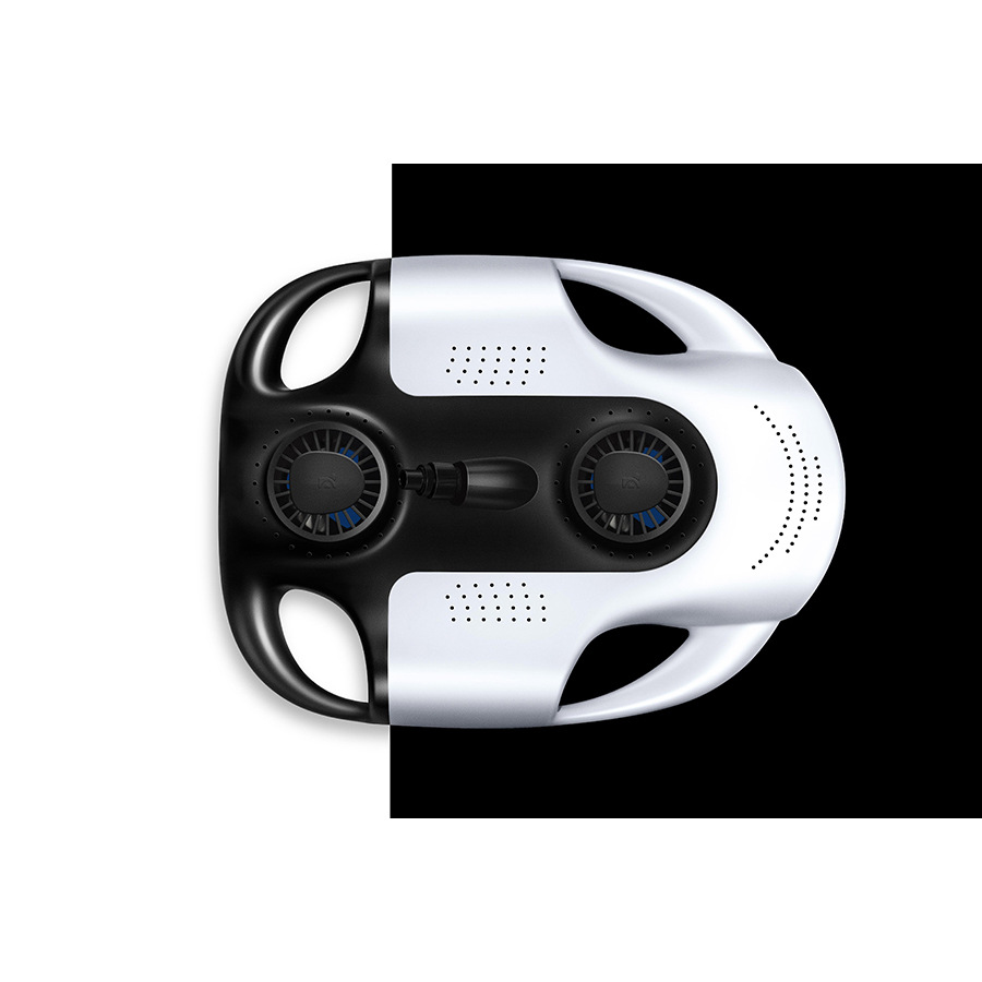
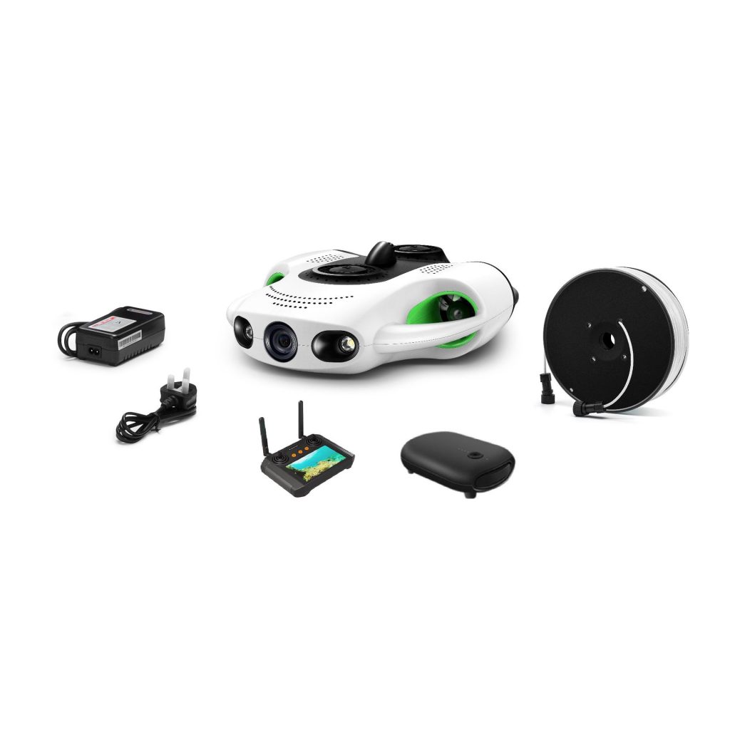
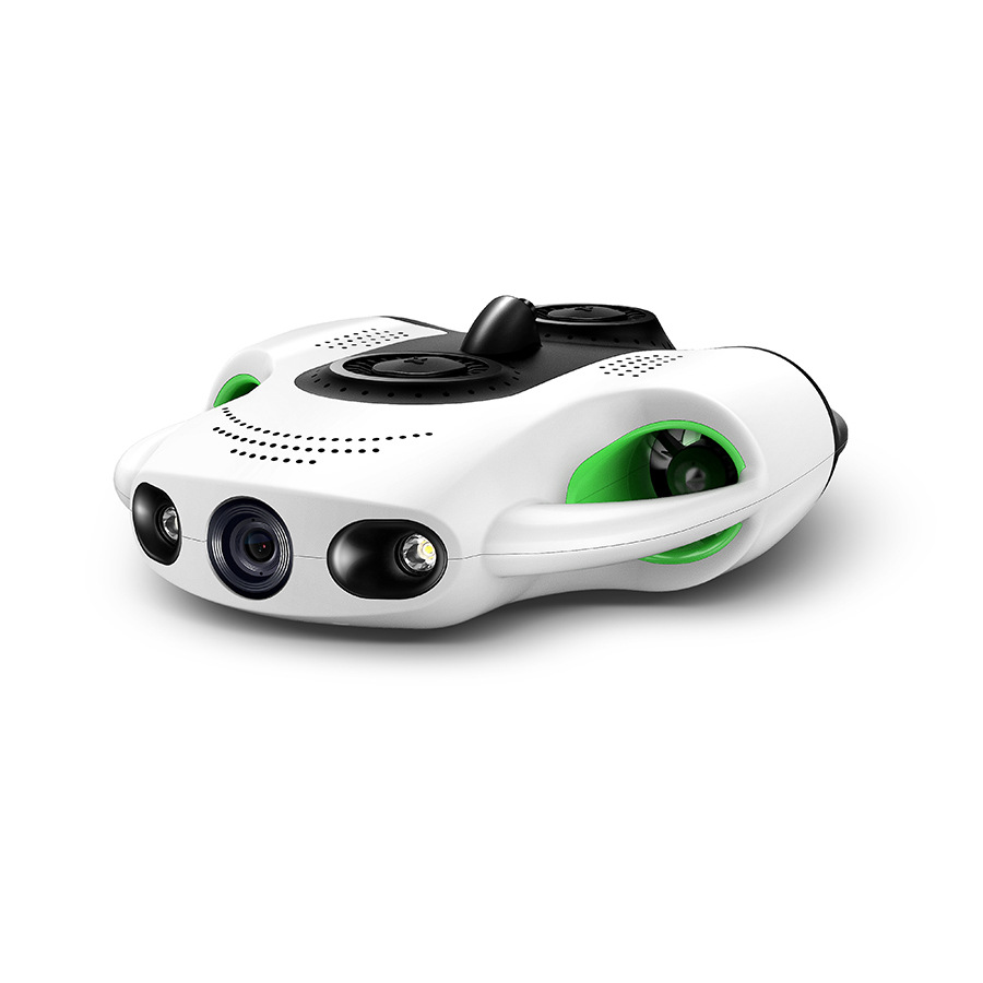
Compactness and Agility: Weighing just 12 kg and measuring 80 cm in length, the MSOEN is small enough to navigate narrow spaces within a wreck, such as between ribs or inside cargo holds. Its modular design allows for easy transport, requiring no large support vessels—ideal for remote sites.
-
High-Resolution Imaging: Equipped with a 4K camera, a 360-degree LiDAR sensor, and multi-spectral imaging capabilities, the drone captures both visual details and 3D spatial data. The LiDAR system uses laser pulses to measure distances with millimeter-level accuracy, creating precise 3D models of the wreck site.
-
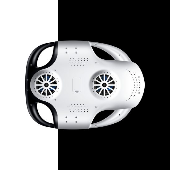
Non-Invasive Operation: The drone’s thrusters generate minimal turbulence, reducing sediment disturbance—a critical factor for preserving fragile organic materials. It also features a soft, non-abrasive exterior to avoid scratching surfaces.
-
Long Endurance: With a battery life of up to 8 hours, the MSOEN can conduct extended surveys without frequent resurfacing, maximizing data collection per dive.
-
Real-Time Data Transmission: Using acoustic modems, the drone streams live footage and sensor data to a surface control unit, allowing operators to adjust its path in real time based on discoveries.
Case Study: Restoring a 1,000-Year-Old Shipwreck
In 2023, a team of archaeologists collaborated with MSOEN engineers to explore a shipwreck discovered off the coast of Southeast Asia, believed to date back to the 11th century CE. Initial sonar scans suggested the wreck was approximately 30 meters long, but its exact structure and condition remained unknown. The MSOEN drone was deployed to map the site and restore its digital twin.
Phase 1: Site Survey and Mapping
The drone began with a grid-based survey, flying at a consistent altitude of 1 meter above the seabed. Its LiDAR sensor collected millions of data points, which were processed using photogrammetry software to create a high-resolution 3D model of the entire wreck. The 4K camera captured close-up images of key features, including the keel, frames, and remnants of the deck.
During this phase, the team identified several unexpected elements: a series of small, rectangular openings along the hull (likely ventilation ports), a partially intact mast step, and clusters of ceramic sherds embedded in the sediment. These details provided clues about the ship’s construction techniques and possible trade routes.
Phase 2: Structural Analysis
With the overall layout mapped, the drone focused on detailed structural analysis. By maneuvering into tight spaces, it captured images of individual frame joints, fastening mechanisms (such as treenails and iron nails), and the curvature of the hull. Multi-spectral imaging revealed differences in material composition—for example, distinguishing between original teak wood and later repairs made with softer timber.
One critical discovery was the presence of a double-bottom structure, a rare feature in ships of this era. This design, likely intended to enhance buoyancy and protect against grounding, suggested the vessel was built for long-distance voyages, possibly across the Indian Ocean.
Phase 3: Digital Reconstruction
Using the 3D model and image data, the team created a virtual reconstruction of the ship. Software algorithms filled in gaps where parts had decayed, guided by comparative studies of similar wrecks from the same period. The result was a dynamic model that allowed researchers to “virtually disassemble” the ship, examining each component’s role in its overall design.
This reconstruction revealed that the ship had a carvel-built hull (planks edge-to-edge) rather than the clinker-built style common in regional vessels of the time. Carvel construction, typically associated with European ships, hinted at cross-cultural exchange or technological transfer—an insight that reshaped existing theories about maritime trade in medieval Southeast Asia.
Advantages of the MSOEN Drone Over Traditional Methods
The success of the project highlighted several key advantages of the MSOEN drone:
-
Precision: Millimeter-level LiDAR data enabled the identification of features as small as 2 mm, far surpassing the resolution of sonar or diver observations.
-
Efficiency: In 72 hours of operation, the drone mapped 90% of the wreck site—equivalent to what would take a team of divers weeks to cover.
-
Safety: By eliminating the need for divers to enter unstable areas, the drone reduced risks of accidents or damage to the site.
-
Data Richness: Combining visual, spatial, and spectral data provided a holistic view of the wreck, enabling interdisciplinary analysis (e.g., linking structural features to cargo types).
Broader Implications for Archaeological Research
The MSOEN drone’s application extends beyond single-site exploration. Its ability to collect standardized, high-quality data makes it ideal for large-scale projects, such as mapping entire underwater cultural landscapes or monitoring changes in vulnerable sites over time. For example, in coral reef environments, the drone can track how shipwrecks interact with marine ecosystems, providing insights into both cultural and natural history.
Moreover, the drone democratizes access to underwater archaeology. Smaller institutions or developing countries, which may lack resources for large ROVs or research vessels, can now participate in global heritage preservation efforts. The MSOEN’s affordability (compared to traditional ROVs) and ease of use further lower barriers to entry.
Future Developments
The MSOEN team is already working on next-generation upgrades, including:
-
AI-Powered Object Recognition: Training algorithms to automatically identify artifacts (e.g., pottery, coins) in image data, speeding up analysis.
-
Enhanced Mobility: Adding robotic arms for gentle artifact retrieval or sediment sampling, expanding the drone’s utility.
-
Deeper Dives: Developing pressure-resistant components to enable exploration down to 200 meters, opening up new frontiers in deep-sea archaeology.
Conclusion
The MSOEN underwater drone represents a paradigm shift in how we engage with submerged cultural heritage. By merging advanced robotics with archaeological expertise, it has unlocked the secrets of a 1,000-year-old shipwreck, revealing details that were once hidden by time and water. As the technology continues to evolve, the MSOEN drone will not only help us understand the past but also ensure that future generations can learn from these underwater treasures.
FAQ: MSOEN Underwater Drone in Archaeological Applications
1. How does the MSOEN underwater drone differ from other ROVs?
The MSOEN drone is purpose-built for archaeology, prioritizing compactness, agility, and non-invasive operation. Unlike generic ROVs, it features a lightweight design (12 kg), 360-degree LiDAR for high-resolution 3D mapping, and soft exteriors to minimize site disturbance. It also offers longer endurance (8 hours) and real-time data transmission, making it more efficient for detailed surveys.
2. What is the maximum depth the MSOEN drone can operate at?
The current model is rated for depths up to 100 meters, suitable for most coastal and shallow-water archaeological sites. A deep-sea variant, capable of diving to 200 meters, is in development.
3. How does the drone ensure the safety of fragile artifacts?
The MSOEN’s thrusters produce minimal turbulence, reducing sediment disturbance. Its slow, controlled movements and soft exterior prevent physical contact with delicate surfaces. Additionally, the drone avoids direct interaction with artifacts unless equipped with specialized tools (e.g., robotic arms for sampling), which are used only when necessary and under strict archaeological supervision.
4. Can the MSOEN drone work in low-visibility conditions?
Yes. While clear water yields the best results, the drone’s LiDAR sensor can penetrate murky conditions better than optical cameras. For extremely turbid sites, multi-spectral imaging helps distinguish features based on material properties rather than color.
5. How is the data collected by the drone analyzed?
Data is processed using photogrammetry software (to create 3D models) and GIS tools (for spatial analysis). Archaeologists collaborate with MSOEN engineers to interpret findings, combining drone data with historical records and comparative studies of similar sites.
6. Is the MSOEN drone accessible to smaller research teams?
Absolutely. Its compact size and portability reduce reliance on large vessels, and its user-friendly interface requires minimal training. MSOEN also offers partnerships with academic institutions to provide affordable access to the technology.
7. What are the environmental benefits of using the MSOEN drone?
By minimizing sediment disturbance and avoiding chemical usage (unlike some traditional survey methods), the drone reduces ecological impact. Its quiet operation also minimizes stress to marine life, making it suitable for protected areas.
8. Can the drone retrieve artifacts?
The standard model focuses on non-invasive documentation, but an optional robotic arm attachment allows for gentle retrieval of small, stable artifacts. All retrievals follow strict archaeological protocols to ensure provenance and context are preserved.
9. How long does it take to map a typical shipwreck?
Mapping time depends on the wreck’s size and complexity. For a 30-meter-long wreck like the 11th-century example, the MSOEN can complete a full survey in 24–48 hours of operation.
10. What is the lifespan of the MSOEN drone?
With proper maintenance, the drone’s core components (motors, sensors) last 5–7 years. Batteries are replaceable, and software updates ensure compatibility with evolving analysis tools.
11. Does the MSOEN drone require a license to operate?
Regulations vary by country, but most jurisdictions classify it as a recreational or scientific drone. Operators should check local laws regarding underwater vehicle use and archaeological permits.
12. How does the drone handle strong currents?
The MSOEN is equipped with advanced stabilization systems, including gyroscopes and adjustable thrusters, allowing it to maintain position in currents up to 1 knot. For stronger currents, operators can anchor the drone temporarily or schedule surveys during calmer tidal periods.
13. Can the drone be used in freshwater environments?
Yes. The drone is waterproof and corrosion-resistant, making it suitable for lakes, rivers, and reservoirs. Its sensors perform equally well in freshwater and saltwater.
14. What training is required to operate the MSOEN drone?
MSOEN provides a 3-day certification program covering basic piloting, data collection, and troubleshooting. Advanced training in archaeological applications is available for research teams.
15. How does the MSOEN drone contribute to public engagement?
The 3D models and virtual reconstructions created by the drone can be shared through museums, online platforms, and educational programs, bringing underwater heritage to audiences worldwide.
16. Are there any limitations to the MSOEN drone?
While highly capable, the drone cannot operate in extreme conditions (e.g., ice-covered waters) or replace human divers for tasks requiring tactile feedback (e.g., assessing artifact fragility by touch). It is designed to complement, not replace, traditional methods.
17. How does the drone’s cost compare to traditional ROVs?
The MSOEN drone is significantly more affordable than industrial ROVs, with prices starting at $50,000 (excluding optional attachments). This makes it accessible to universities, NGOs, and government agencies with limited budgets.
18. Can the drone detect buried artifacts?
The LiDAR sensor maps surface features, but for buried objects, the drone can be paired with ground-penetrating radar (GPR) attachments (under development) to identify subsurface anomalies.
19. What happens if the drone malfunctions underwater?
The drone includes fail-safe mechanisms: automatic surfacing if communication is lost, redundant sensors, and a buoyant floatation device for recovery. MSOEN also offers 24/7 technical support for emergency situations.
20. How can archaeologists collaborate with MSOEN?
MSOEN welcomes partnerships with research institutions, museums, and cultural heritage organizations. Interested parties can contact the company directly to discuss project-specific requirements and customization options.
THE END


No comments yet