


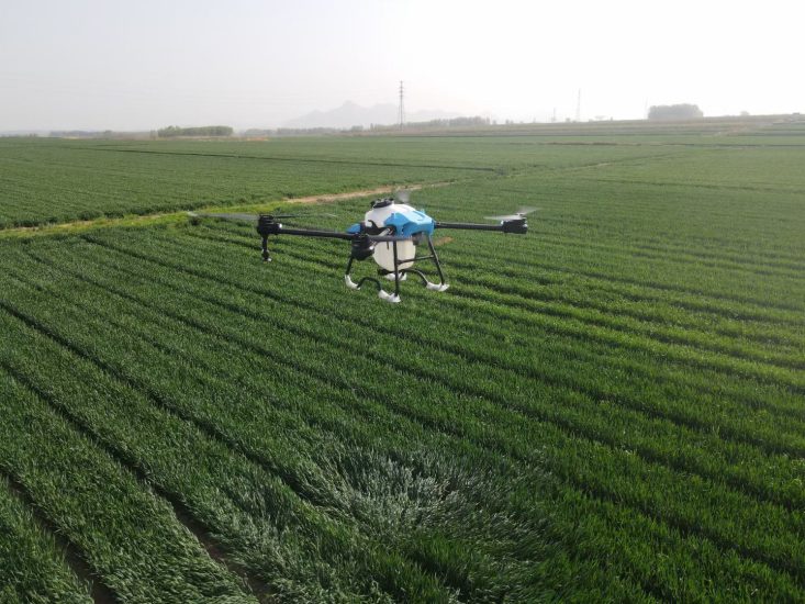
In agriculture, a few centimeters can decide everything. Spray a few meters off course and the pesticide misses the target row, lands on a neighbor’s field, or drifts into a waterway. Spray with a few centimeters of precision and every droplet hits the leaf it was meant for. The difference between these two outcomes is the difference between wasted chemical and protected yield — and it comes down to one thing: positioning accuracy.
MSOEN agricultural spraying drones are built on a simple but powerful principle: the pesticide should land exactly where it is needed, and nowhere else. To deliver that precision, every MSOEN drone combines intelligent flight control with centimeter-level RTK (Real-Time Kinematic) positioning. Together, these technologies transform spraying from a guessing game into a science.
This article explains how MSOEN’s intelligent flight control and RTK positioning work, why centimeter-level accuracy matters in real farming conditions, and what measurable benefits farmers gain when every droplet is placed with precision.
The Problem: Why GPS Alone Isn’t Enough
Standard satellite navigation (raw GPS) typically drifts 1–3 meters from the true position. For consumer navigation, that’s fine — being off by a meter or two still puts you on the right street. But in agricultural spraying, 1–3 meters of drift shows up as visible stripes across the crop, missed strips next to overlapping passes, and chemical landing where it shouldn’t.
Industry observers put it bluntly: flying a spray drone without RTK means guessing about the position of the drone and the ground targets — and guessing costs money. A drone without RTK might wander across the field trying to do good work, but it is not yet a true farming tool.
The consequences of imprecise positioning are well documented:
-
Overlapping passes waste chemical and can cause phytotoxicity (plant burn)
-
Missed strips leave pests and diseases untreated, creating outbreak hotspots
-
Chemical drift onto neighboring crops or waterways creates legal and environmental liabilities
-
Uneven dosage leads to inconsistent crop protection and variable yields
This is why MSOEN integrates RTK directly into its agricultural drone platforms — not as an optional extra, but as a core technology for precision farming.
How MSOEN RTK Positioning Works
RTK technology improves standard satellite navigation accuracy by using a fixed ground reference station and real-time correction signals. The system generally includes an RTK base station, GNSS receiver, flight control system, wireless communication module, and automatic navigation software. The base station continuously calculates positioning correction data and transmits it to the drone, which then adjusts its positioning information in real time.
The result: centimeter-level positioning accuracy. MSOEN integrates RTK base stations directly into its drones, providing the precision necessary to prevent drift and ensure chemicals are sprayed exactly on target.
For MSOEN drone operators, this means:
-
Consistent flight paths even in strong wind conditions
-
Zero overlap between adjacent passes
-
Zero missed strips — 100% field coverage
-
Boundary protection — chemicals stay inside the field, never drifting to neighboring crops or waterways
This centimeter-level accuracy is described by MSOEN as “a critical legal and environmental safeguard” — because it prevents the drone from drifting due to wind and ensures that chemicals are not sprayed on neighboring fields.
MSOEN Intelligent Flight Control: The Brain Behind the Precision
Hardware alone does not spray precisely — it takes intelligent software to turn RTK data into perfect application. MSOEN’s intelligent flight control system manages every aspect of the mission:
1. Automatic Route Planning
MSOEN’s software uses machine learning to analyze field boundaries, no-fly zones, and wind patterns. It generates the most efficient flight path to minimize overlap and ensure 100% coverage.
2. Real-Time Monitoring and Adjustment
The intelligent flight controller monitors navigation, altitude, speed, route planning, and spraying operations automatically. When flying over dense crop canopies, the flow rate increases; over sparse areas, it decreases. This variable-rate application saves farmers millions in chemical costs annually.
3. Terrain-Following Radar
Farms are rarely flat. MSOEN drones are equipped with terrain-following radar that automatically adjusts flight height according to ground conditions. This keeps the drone at the optimal distance above the crop canopy — critical for uniform droplet deposition — even over hills, orchards, or uneven plantation terrain.
4. Obstacle Avoidance
Radar, vision sensors, and ultrasonic systems help detect obstacles and improve operational safety. The drone navigates safely around trees, poles, and terrain features while maintaining its precision route.
5. One-Click Mission Execution
Once the route is planned, the drone takes off automatically, follows the pre-set path, sprays evenly across the field, and returns to base — all while the operator monitors battery level, spray volume, and flight stability in real time.
The MSOEN M50: Precision in Practice
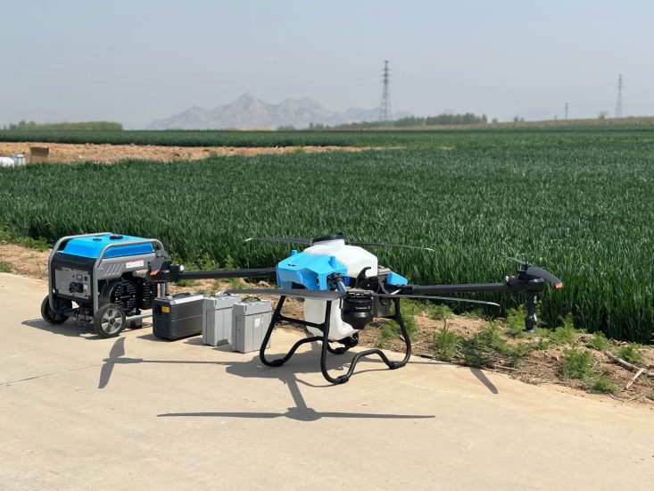
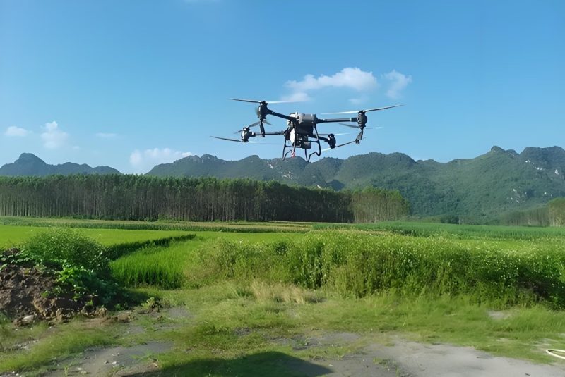
The MSOEN M50 Agricultural Drone exemplifies how intelligent flight control and RTK positioning come together in a production machine. Built for large-scale precision farming, the M50 delivers:
-
50-liter tank capacity for maximum coverage per flight
-
6–10 meter spray width with uniform droplet distribution
-
GPS + optional RTK for centimeter-level precision positioning
-
Automatic route planning and one-click takeoff/landing
-
Terrain-following radar and obstacle avoidance system
-
10–20 minutes flight time per battery, with fast-charging support
-
150–300 acres covered per day depending on operation conditions
-
Applications: rice fields, wheat farms, corn fields, fruit orchards, sugarcane plantations
The M50 is designed for distributors, farm owners, and agricultural service providers who need a complete solution to increase productivity while reducing labor costs. With intelligent flow control, spraying volume automatically changes according to flight speed and operational requirements — ensuring precise dosing regardless of terrain or crop density.
Measurable Benefits: What Centimeter-Level Precision Delivers
The combination of MSOEN intelligent flight control and RTK positioning produces results that are not theoretical — they are measured in real farming operations.
Benefit 1: Dramatic Reduction in Chemical Waste
Precise route planning minimizes overlap spraying and reduces pesticide or fertilizer consumption. In a 2026 peer-reviewed study in maize fields, agricultural UAVs equipped with RTK-GPS and intelligent recognition systems achieved:
-
Average positioning error: 3.4 cm (centimeter-level precision)
-
Pesticide usage: 28.0 L/ha vs. 52.5 L/ha for conventional uniform spraying
-
Disease incidence reduced to under 7% post-application
-
Pesticide utilization rate: 82–83% vs. 48.3% for conventional methods
This means over 45% reduction in chemical inputs while maintaining — and even improving — pest control efficacy.
Benefit 2: Up to 92% Water Savings
In a large-scale demonstration in Xinjiang, China, intelligent agricultural drones equipped with high-pressure atomizing nozzles and centimeter-level navigation (via BeiDou RTK) achieved:
-
Single-day operation area: 400 acres
-
Operational efficiency: 26× higher than traditional manual methods
-
Water-saving rate: 92%
-
Pesticide saving: 50% (dosage adjusted from 1.2 L/mu to 0.6 L/mu)
-
Pesticide drift rate controlled below 5%
-
Soil pesticide residue reduced by 38%
-
Farmer labor intensity reduced by 70%+
Annual regional impact: 120 tons of pesticide saved and 4.5 million m³ of water conserved.
Benefit 3: Elimination of Stripes and Missed Coverage
Without RTK, ordinary GPS-guided plant protection drones suffer from positioning deviations that cause uneven spraying — leaving fields looking like “football pitches” with green and yellow stripes where leaves fail to wither uniformly. With MSOEN’s RTK positioning, the drone flies like it’s on rails, achieving repeatable precision that ensures no duplication, no omission — uniform application across every square meter.
Benefit 4: Environmental Protection and Legal Safety
Accurate spraying reduces chemical runoff and environmental contamination. Just as importantly, centimeter-level RTK positioning is a critical legal and environmental safeguard: it prevents the drone from drifting due to wind and ensures that chemicals are not sprayed on neighboring fields. For commercial farming operations, this protection is invaluable.
Benefit 5: Adaptability to Complex Terrain
Drones with RTK and intelligent flight control can operate efficiently in mountainous regions, orchards, rice fields, and uneven terrain. In Xinjiang’s mountain pasture areas, terrain-following drones automatically avoided gullies and slopes, raising pesticide coverage from 65% (manual) to 95% — and increasing wheat rust control efficacy from 70% to 90%.
Benefit 6: Significant Labor Cost Reduction
Drone automation significantly reduces manual labor requirements in large-scale farming. A single operator can manage what previously required an entire crew. In the Xinjiang demonstration, labor intensity was reduced by over 70%.
The Science of Precision: Why Centimeter-Level Matters
The principle behind MSOEN’s precision is straightforward but profound:
-
Raw GPS gets you close — within 1–3 meters — but close doesn’t cut it when following the exact path your tractor took.
-
RTK correction tightens that accuracy to an inch or two by comparing satellite signals against the known fixed position of base stations, filtering out atmospheric interference and timing variations.
-
Intelligent flight control takes that precise positioning and translates it into automated, repeatable flight paths with variable-rate spraying.
-
The result: every droplet lands exactly where it should — on the target crop, at the optimal dosage, with zero drift.
This is the essence of precision agriculture: not just spraying, but spraying exactly where needed.
MSOEN’s Complete Precision Ecosystem
MSOEN doesn’t stop at RTK and flight control. The company’s AgriOS software platform adds layers of intelligence:
AI-Powered Flight Planning
Machine learning analyzes field boundaries, no-fly zones, and wind patterns to generate the most efficient flight path.
Data Analytics and Prescription Maps
Using optional multispectral sensors, MSOEN drones generate NDVI (Normalized Difference Vegetation Index) maps that identify areas of crop stress. This allows farmers to apply targeted treatments rather than blanket spraying — the true future of precision agriculture.
Real-Time Monitoring
Operators receive live operational data during spraying tasks, monitoring flight status, spraying conditions, and field coverage in real time.
Electrostatic Spray Option
MSOEN offers an electrostatic charging system that gives droplets a positive charge, causing them to wrap around plant leaves (both top and bottom) like a magnet. This increases deposition efficiency by up to 65%.
Built for Global Agriculture
MSOEN agricultural drones are designed to operate in various environments, including farms, plantations, hills, and different climate conditions. From the freezing temperatures of -20°C in northern China to the high humidity of tropical plantations, MSOEN drones are rated IP67 (ingress protection) — dust-tight and capable of withstanding temporary water immersion.
MSOEN’s agricultural drone range typically supports payloads from 5L to 150L, with custom configurations available based on operational needs. This ensures that every farm — from smallholding to industrial plantation — can access centimeter-level precision.
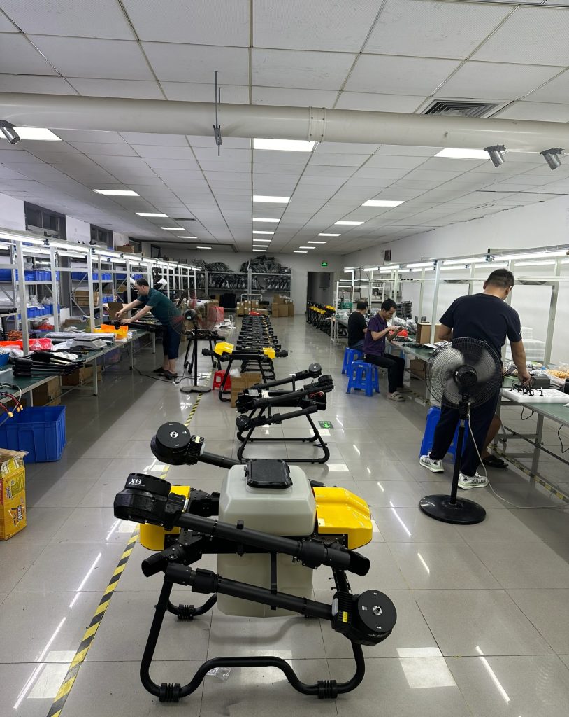
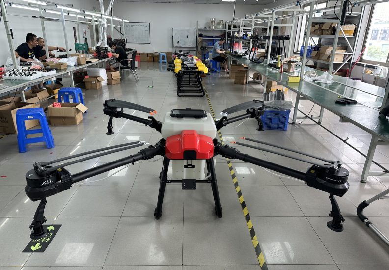
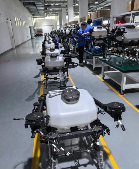
MSOEN Manufacturing: Engineering Precision at Scale
Precision is not just a software feature — it’s a manufacturing discipline. MSOEN’s facility features:
-
Automated SMT (Surface Mount Technology) lines for PCB assembly, ensuring zero human error in soldering critical flight control components
-
Rigorous aging tests — each drone runs at full throttle for 4 hours in a controlled wind tunnel before leaving the factory
-
IP67 environmental testing in extreme conditions from -20°C to high tropical humidity
-
Full OEM/ODM customization for distributors and agricultural brands worldwide
-
Global shipping with DDP (Delivered Duty Paid) service for many countries
-
Regional service hubs stocking critical spare parts (pumps, nozzles, ESCs) for rapid repair
-
Training and certification programs — MSOEN doesn’t just sell drones, it builds operator capability
Why “Spraying Exactly Where Needed” Is the Future of Farming
The economics of modern agriculture demand precision. Consider a typical scenario:
A farmer manages 1,000 acres of mixed crops. Using traditional manual spraying:
-
Labor: 5–20 workers for large fields
-
Water: 200–500 L/ha (knapsack) or 300–750 L/ha (tractor)
-
Pesticide use: Baseline 100%
-
Coverage speed: 1–3 ha/day (manual) or 15–30 ha/day (tractor)
-
Drift risk: Moderate to high
Switching to an MSOEN RTK-equipped drone:
-
Labor: 1–2 operators
-
Water: 10–20 L/ha — a 70–90% reduction
-
Pesticide use: 30–40% reduction vs. baseline
-
Coverage speed: 30–100+ ha/day
-
Drift risk: Lower, with precise altitude control and targeted nozzles
-
Positioning accuracy: Centimeter-level, eliminating overlap and missed strips
The 2025 FAO-documented paddy field trial tells the same story: a drone covered 9 acres in just 1.2 hours compared to 34.3 hours for manual spraying — a 28.6× increase in time efficiency — while reducing water consumption from 240L to 72L and minimizing pesticide wastage through precise targeting.
The Bottom Line: Precision Pays
When you choose MSOEN agricultural spraying drones with intelligent flight control and RTK positioning, you are choosing:
✅ Centimeter-level accuracy — RTK corrects GPS drift from meters to inches
✅ Zero overlap, zero missed strips — 100% field coverage through AI-powered route planning
✅ Up to 50% pesticide savings — variable-rate application based on real-time conditions
✅ Up to 92% water savings — ultra-low-volume precision spraying
✅ Under 5% drift rate — environmental and legal protection
✅ All-terrain operation — terrain-following radar for hills, orchards, and plantations
✅ Data-driven decisions — NDVI maps and prescription analytics for targeted treatment
✅ A true manufacturing partner — OEM/ODM, global shipping, regional service hubs, and comprehensive training
Conclusion: Spray Smarter, Not Just Faster
The agricultural drone industry has matured. Farmers no longer ask whether to adopt drone technology — they ask which drone will give them the precision they need to protect their crops, their investment, and their environment.
MSOEN’s answer is clear: combine intelligent flight control with centimeter-level RTK positioning to spray pesticides exactly where needed. The technology is proven. The results are measured. The savings are real.
From the MSOEN M50’s 50-liter tank and 150–300 acres/day capacity, to the smallest 5L model for smallholder farms, every MSOEN drone shares the same commitment to precision. Every droplet is placed with intent. Every flight follows the optimal path. Every field receives exactly what it needs — no more, no less.
This is what modern agriculture demands. This is what MSOEN delivers.
Contact MSOEN today to discuss your farm’s specific requirements, request a product demonstration, or explore OEM/ODM opportunities. Discover why MSOEN’s intelligent flight control and RTK positioning are redefining precision agriculture worldwide — and why, with MSOEN, you’ll be spraying pesticides exactly where needed, every single time.
THE END


No comments yet