




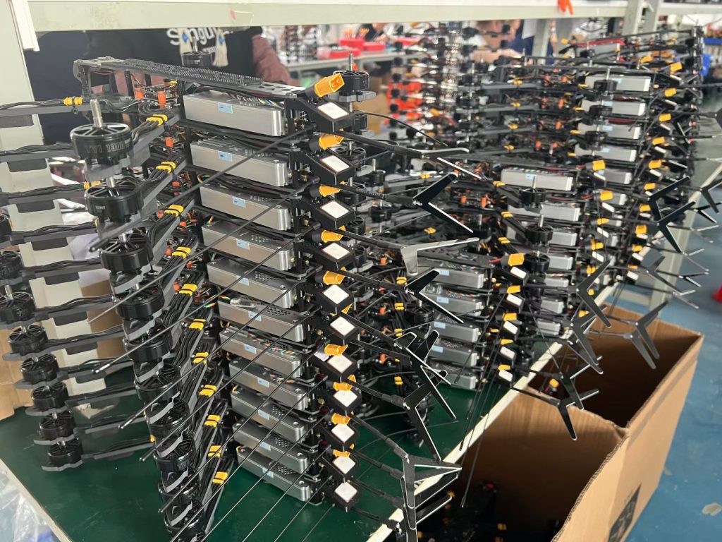

Effective forest management and conservation require accurate, timely, and wide-area data. MSOEN forest monitoring drones provide aerial surveillance, enabling:
- Tree health assessment
- Deforestation detection
- Fire risk monitoring
- Biodiversity and wildlife habitat mapping
MSOEN drones combine high-resolution imaging, multispectral sensors, and autonomous flight capabilities to help forestry teams collect critical data faster and safer.
🌲 Why Forest Monitoring Drones Are Essential
Traditional forest monitoring methods, such as ground inspections and satellite imaging, have limitations:
- Limited coverage and time-consuming
- High operational costs
- Difficult access to remote or dense forests
- Low-resolution or delayed data
MSOEN forest drones solve these issues by:
- Covering large forest areas quickly
- Capturing high-resolution RGB and multispectral images
- Operating safely in dense or hazardous terrain
- Providing real-time, actionable data
💰 Cost of Forest Monitoring Drones
Drone pricing depends on sensor type, flight range, and payload.
🔹 Entry-Level Drones
- Price: $7,000 – $12,000
- Range: 5–10 km
- Ideal for small forest patches and short-range monitoring
🔹 Mid-Range Drones
- Price: $12,000 – $25,000
- Range: 10–20 km
- Equipped with RGB and multispectral cameras, GPS navigation
- Suitable for medium-sized forests and research projects
🔹 Professional Drones
- Price: $25,000 – $50,000+
- Range: 20–50 km+
- Advanced payload with thermal, infrared, and multispectral sensors
- Long endurance for large national forests or conservation areas
🚁 MSOEN Forest Monitoring Drone Solution
MSOEN drones are engineered for precision, durability, and efficiency:
🔹 Key Features
- Autonomous GPS/RTK navigation for accurate mapping
- Long-range flight with extended battery life
- Multi-sensor payload: RGB, thermal, infrared, and multispectral cameras
- Real-time data transmission to base stations or cloud platforms
- Durable, weather-resistant construction for all forest conditions
🔹 Applications
- Forest health and tree monitoring
- Deforestation and illegal logging detection
- Fire risk assessment and early warning
- Wildlife habitat mapping and biodiversity surveys
- Research in ecosystem health and climate impact
📊 Technical Specifications to Consider
When selecting a forest monitoring drone:
✅ Flight Endurance
Long endurance ensures large area coverage without frequent battery changes.
✅ Sensor Accuracy
High-resolution RGB and multispectral imaging for detailed forest analysis.
✅ Real-Time Data
Immediate telemetry allows rapid decision-making for forest management.
✅ Stability & Durability
Drones must withstand wind, rain, and dense forest conditions safely.
✅ Automation & Safety
Pre-set flight paths and automated missions reduce operator error and enhance safety.
🌐 Benefits Compared to Traditional Methods
| Method | Coverage | Data Accuracy | Labor Cost | Safety |
|---|---|---|---|---|
| MSOEN Drone Monitoring | High | High | Low | High |
| Ground Inspections | Low | Medium | High | Medium |
| Satellite Imaging | Medium | Medium | Medium | High |
MSOEN drones provide efficient, accurate, and non-intrusive forest monitoring, improving decision-making and conservation efforts.
🔧 Who Should Use Forest Monitoring Drones?
- Forestry management agencies
- National parks and conservation authorities
- Environmental NGOs and research institutions
- Fire monitoring and prevention teams
- Universities conducting ecological studies
❓ FAQ – Forest Monitoring Drone
1. Can MSOEN drones operate in dense forests?
Yes, drones are designed for stable flight and precise navigation under tree canopies.
2. Can they detect early signs of forest fires?
Yes, thermal and infrared sensors allow early detection of heat spots and fire risks.
3. Is training required to operate?
Minimal training is needed; automated flight and mapping features simplify operations.
4. How quickly is data available?
Real-time telemetry provides immediate access for analysis and reporting.
5. Can data integrate with GIS and forest management software?
Yes, compatible with GIS, cloud platforms, and forestry analysis tools.
🌳 Case Study – Forest Health Monitoring
“Using MSOEN drones, our forestry team monitored over 100 km² of dense forest in just a few days. The drones provided multispectral and thermal imaging to assess tree health and detect early signs of disease. Compared to traditional ground surveys, we reduced labor costs and improved monitoring accuracy significantly.”
📞 Get Your MSOEN Forest Monitoring Drone
Looking for a reliable drone for forest and ecosystem monitoring? MSOEN provides:
- Full technical specifications
- Customizable sensor payload options
- Pricing and delivery support
- Technical guidance and training
🚀 Enhance forest management and conservation efforts with MSOEN drones — faster, safer, and more precise.
🏷️ Suggested Tags (SEO-Friendly)
forest monitoring drone, MSOEN forestry UAV, tree health drone, multispectral forest drone, deforestation detection drone, wildfire early detection UAV, RGB and thermal forest drone, wildlife habitat mapping UAV, national park monitoring drone, ecological survey drone, automated forest mapping UAV, GPS forest drone, environmental research UAV, long-range forestry drone, drone for forest conservation




No comments yet