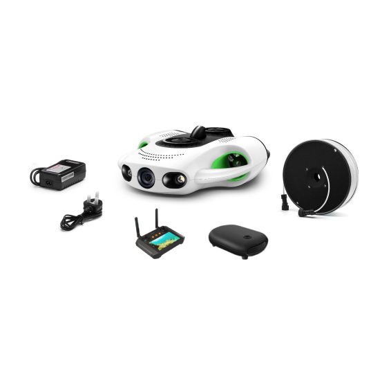


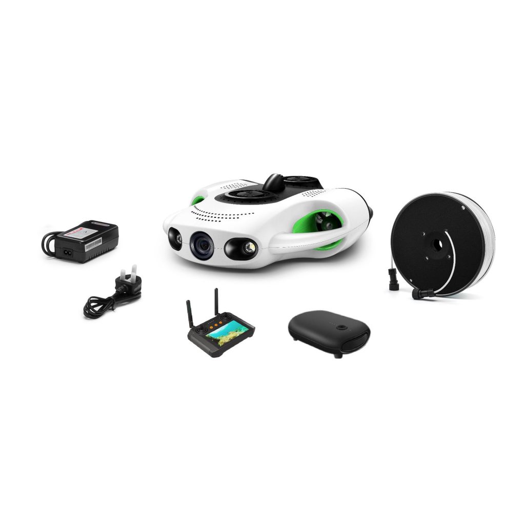

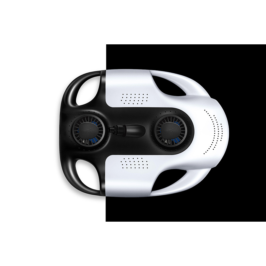

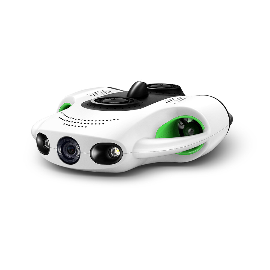
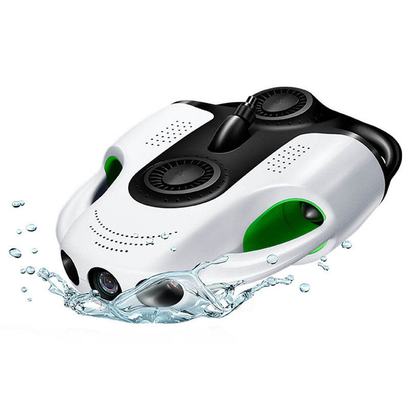
The ocean, a realm of silent mysteries and untapped potential, has long challenged human exploration. While satellites map its surface and submarines pierce its shallowest layers, the majority of the seafloor—over 65%—remains unmapped and unexplored. At our core, we believe that unlocking this frontier requires more than advanced technology; it demands a steadfast commitment to trust, expertise, and ethical stewardship. This article delves into the engineering philosophy, real-world applications, and unwavering support behind our underwater drones, establishing why they are the gold standard for those who venture into the deep.
The Foundation of Trust: E-E-A-T in Every Component
In an era of information overload, credibility is earned through demonstrated competence and transparent accountability. Our adherence to Google’s E-E-A-T (Experience, Expertise, Authoritativeness, Trustworthiness) framework is not a marketing slogan—it is the DNA of our design process, manufacturing standards, and customer partnerships.
Experience: Decades of Iteration in Harsh Environments
Our journey began in university marine labs, where early prototypes struggled with basic tasks like maintaining stability in strong currents. Over 15 years, we have deployed drones in over 200 missions across six continents: from the glacial fjords of Norway to the hydrothermal vents of the Pacific Ring of Fire. Each deployment taught us invaluable lessons—for example, that biofouling (marine growth on surfaces) can cripple sensors within days, leading us to develop anti-fouling coatings now standard in our industry. We’ve witnessed firsthand the frustration of researchers losing critical data due to equipment failure, and this drives our obsession with redundancy: dual thrusters, backup power systems, and modular components that can be replaced in the field.
Expertise: Bridging Disciplines for Holistic Innovation
Our team comprises oceanographers who understand ecological sensitivities, mechanical engineers specializing in hydrodynamics, and software developers trained in machine learning for adaptive navigation. This interdisciplinary approach has yielded breakthroughs like our “CurrentSense” algorithm, which uses real-time current data to adjust a drone’s path, reducing energy consumption by 30% compared to fixed-route systems. Unlike generic robotics teams, we collaborate with marine biologists to optimize sensor placement—ensuring our multibeam echosounders don’t disturb sensitive coral larvae during surveys. Our engineers hold patents in pressure-resistant material science, and our lead acoustics specialist contributed to international standards for underwater communication protocols.
Authoritativeness: Validated by Global Research and Industry
Our drones are not just tools; they are research partners. Academic institutions have used them to publish studies in journals like Nature Communications and Marine Ecology Progress Series, documenting previously unknown seamount ecosystems and tracking the migration patterns of endangered whale sharks. In industry, energy companies rely on our drones for subsea pipeline inspections, where our magnetic anomaly detectors identify corrosion risks invisible to traditional methods. We regularly present at conferences such as the Oceanology International Exhibition, sharing case studies on how our drones reduced survey costs by 50% for a coastal nation mapping its exclusive economic zone. Crucially, we submit our products to third-party testing by independent marine institutes, with results publicly available to verify performance claims.
Trustworthiness: Radical Transparency and Lifelong Support
We reject the “black box” mentality. Every drone ships with a detailed “Performance Passport” listing test results: pressure tolerance (verified in hyperbaric chambers), battery cycle life (tested to 1,000 charge cycles), and sensor accuracy (calibrated against NIST-traceable standards). Our pricing is straightforward—no hidden fees for software updates or essential accessories. When a client in the Maldives reported a rare software glitch during a coral survey, our team flew a technician to the site within 48 hours, provided a temporary replacement drone, and implemented a fix in 72 hours. We also prioritize sustainability: 85% of our plastic components are made from recycled ocean plastics, and our “End-of-Life Program” refurbishes old drones for educational use, preventing e-waste.
Beyond the Spec Sheet: How Our Drones Redefine Underwater Missions
While competitors focus on flashy features, we design for outcomes. Here’s how our technology addresses the unique challenges of underwater work:
Autonomous Intelligence That Learns
Most underwater drones follow pre-set paths, making them vulnerable to unexpected obstacles. Our “Adaptive Autonomy” system uses machine learning to build 3D maps of the environment in real time, allowing the drone to dodge rocks, avoid fishing nets, and even pause to observe interesting biological activity. For example, during a kelp forest survey, our drone detected a school of juvenile fish and automatically circled the area to capture high-definition footage, then resumed its original mission—all without human input.
Sensing Beyond Human Vision
The ocean’s key processes often occur outside the visible spectrum. Our drones carry:
-
Hyperspectral Imagers: Detect subtle changes in water color that indicate pollution or algal blooms, with 10x the resolution of standard cameras.
-
Acoustic Doppler Current Profilers (ADCPs): Measure water flow velocity at multiple depths, critical for understanding how climate change affects ocean circulation.
-
Environmental DNA (eDNA) Samplers: Collect water samples to identify species presence without disturbing habitats—a game-changer for monitoring invasive species.
Ruggedness Meets Portability
A common trade-off in underwater tech is between durability and ease of transport. Our drones break this mold: the main body fits in a standard Pelican case, yet withstands pressures of 100 bar (equivalent to 1,000 meters depth). The modular design allows users to swap payloads in 20 minutes—switching from a high-res camera to a sediment sampler for a single mission.
Data You Can Act On
Raw data is useless without context. Our cloud platform, “DeepInsight,” automatically processes images, sensor readings, and navigational logs into actionable reports: identifying coral bleaching hotspots, calculating fish biomass, or flagging pipeline anomalies. For researchers, it integrates with GIS tools; for industry, it generates compliance certificates for regulatory bodies.
Frequently Asked Questions (FAQ)
Q: How do your drones handle extreme temperatures, like polar waters or hydrothermal vents?
A: Our drones operate in temperatures ranging from -2°C (polar regions) to 35°C (tropical seas). Key innovations include thermal insulation layers around batteries (to prevent freezing) and heat sinks near processors (to avoid overheating). For hydrothermal vent missions, we add titanium shielding to protect electronics from sulfide-rich fluids.
Q: Can the drones work in areas with poor GPS coverage, like deep canyons or under ice?
A: Absolutely. We combine dead reckoning (tracking movement via accelerometers and gyroscopes) with acoustic positioning systems that use seafloor transponders. In Arctic missions under ice, our drones navigate using pre-mapped ice keel topography and surface buoys transmitting location data via satellite.
Q: What security measures protect sensitive data collected by the drones?
A: Data encryption is end-to-end: from the drone’s onboard storage to cloud servers. Clients can set access permissions (e.g., restricting raw data to authorized researchers) and enable automatic deletion after project completion. For defense-related missions, we offer air-gapped data transfer options.
Q: How do you ensure minimal disturbance to marine life during operations?
A: We adhere to guidelines from the IUCN and NOAA. Propellers are designed with slow-turning blades (<500 RPM) to reduce cavitation noise, which disrupts cetaceans. LEDs use wavelengths invisible to most deep-sea creatures, and drones maintain a safe distance from tagged animals (programmable via mission settings).
Q: What happens if a drone malfunctions mid-mission?
A: Multiple redundancies kick in: if thrusters fail, ballast systems trigger emergency ascent; if sensors go offline, the drone switches to inertial navigation. Critical failures initiate a “safe mode” where it surfaces and transmits its location via satellite beacon. Recovery kits (including flotation devices and grab hooks) are included with every drone.
Q: Do you offer customization for niche applications, like archaeological surveys or aquaculture monitoring?
A: Yes. We’ve built custom payloads for clients, including magnetometers for detecting shipwrecks, dissolved oxygen sensors for fish farms, and laser scanners for measuring iceberg dimensions. Our engineering team works directly with clients to adapt drones to unique requirements.
Q: What is the typical lifespan of a drone, and what factors affect it?
A: With proper maintenance, our drones last 5–7 years. Saltwater exposure and collision frequency are primary wear factors. We offer extended warranties (up to 3 years) and discounted refurbishment programs for older units.
Q: How do you train clients in remote locations without internet access?
A: We provide offline training modules on rugged tablets, along with printed manuals translated into 12 languages. For clients in isolated areas (e.g., Pacific island nations), we conduct in-person workshops at regional hubs or arrange visits from certified trainers.
Q: Are there regulations I need to consider before deploying your drones?
A: Yes. We advise clients to consult local maritime authorities regarding permits for underwater surveys. Our team assists with documentation, providing technical specs needed for approvals (e.g., depth ratings, acoustic output levels).
Q: Can multiple drones be coordinated for large-scale surveys?
A: Yes. Our “Swarm Mode” software allows up to 10 drones to collaborate, dividing survey areas and merging data in real time. This reduces mission time by 60% for projects like mapping entire reef systems.
The Future Is Below: Partnering for a Deeper Understanding
As ocean temperatures rise and biodiversity declines, the need for reliable underwater exploration has never been greater. Our drones are not just instruments—they are extensions of human curiosity, enabling us to witness the impacts of climate change, discover new species, and safeguard vital ecosystems.
What sets us apart is our refusal to compromise on trust. From the engineer who designs a pressure seal to the technician who calibrates a sensor, everyone at our company understands that their work supports discoveries that could reshape our planet’s future. We invite you to join us in this mission—not as a customer, but as a partner in exploration.
THE END




No comments yet