




Diary Entry – A Full Day Conducting Earthquake Search and Rescue Missions with Drones
5:00 AM – Early Preparation and Briefing
Today began with an early briefing for an earthquake search and rescue operation. Rapid assessment and immediate action are critical in earthquake situations, and drones have become indispensable tools for emergency teams.
Earthquake search and rescue drones provide aerial visibility, thermal imaging, and high-resolution real-time data. These capabilities enable teams to locate survivors quickly, assess structural damage, and plan safe response strategies.
The day’s schedule included surveying collapsed structures, monitoring unstable areas, assisting ground rescue teams, and providing detailed aerial data for operational planning.
5:30 AM – Drone Pre-Flight Check
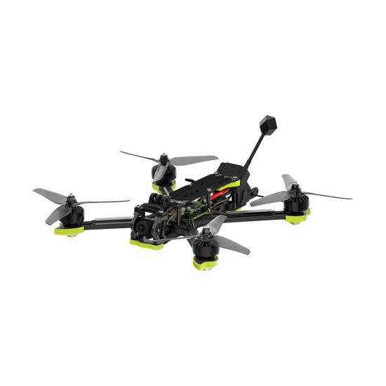
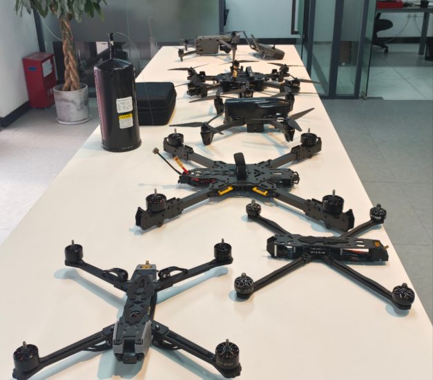
Before deployment, I conducted a thorough inspection of the drone. Battery levels were verified, propellers checked for integrity, sensors calibrated, and GPS connectivity tested.
Earthquake zones present multiple challenges—unstable buildings, debris, and unpredictable conditions. Ensuring drone stability and reliable operation is critical for both data accuracy and team safety.
The thermal imaging and high-resolution cameras were tested. Thermal sensors are particularly valuable for detecting heat signatures of trapped individuals, while high-resolution imagery captures structural damage for detailed analysis.
6:00 AM – Initial Aerial Assessment
The first mission involved surveying a densely populated urban area affected by a recent earthquake.
The drone quickly ascended and transmitted live video feeds to the command center. From above, I could see collapsed buildings, blocked streets, and areas where people might be trapped.
This aerial perspective allowed rescue teams to prioritize their efforts and allocate resources efficiently. Avoiding hazardous zones while identifying critical rescue points is one of the key advantages of drones in earthquake response.
7:30 AM – Thermal Imaging Search for Survivors
After assessing the initial damage, the drone switched to thermal imaging mode to locate potential survivors.
Even through rubble, heat signatures revealed human presence in areas inaccessible to ground teams. One trapped individual was identified on the second floor of a partially collapsed building. Coordinates were relayed instantly to the rescue team, enabling a swift and safe extraction.
Thermal imaging is particularly valuable in post-earthquake scenarios, especially during low-light or obscured conditions.
9:00 AM – Structural Damage Mapping
Next, the drone conducted high-resolution scans of damaged buildings.
Detailed imagery was collected to create 3D maps of collapsed structures and unstable zones. This information helps engineers and emergency teams plan safe access routes and identify high-risk areas.
Using drones in structural assessment reduces risk to personnel and allows teams to focus on priority rescue operations.
10:30 AM – Remote Area Reconnaissance
Some affected neighborhoods were difficult to access due to debris, landslides, or blocked roads.
The drone flew over these areas, providing real-time situational awareness and identifying locations where individuals may be stranded.
Aerial reconnaissance allows rescue teams to cover larger areas in less time, ensuring no one is left behind during the critical first hours after an earthquake.
12:00 PM – Data Review and Mission Coordination
At midday, I reviewed all collected footage and thermal data.
Information included:
- Location of trapped individuals
- Collapsed structures and unstable buildings
- Blocked roads and debris zones
- Hazardous areas with potential secondary risks
This data was shared with all field teams, enabling coordinated and effective operations.
12:30 PM – Battery Replacement and Maintenance
After several flight missions, the drone returned for battery replacement and inspection.
Regular maintenance is essential when operating in dusty, smoky, or debris-filled environments. Clean lenses, calibrated sensors, and fully charged batteries ensure reliable performance for the next critical mission.
1:30 PM – Nighttime Preparedness and Low-Light Operations
Although it was still daytime, preparations were made for potential low-light or nighttime operations.
The drone’s thermal imaging and infrared systems were tested for night missions. Low-light capability is essential for ongoing rescue efforts, especially if survivors are trapped in areas with limited visibility.
2:00 PM – Ongoing Search and Rescue Support
The drone continued assisting ground teams by monitoring hazardous areas and identifying potential survivor locations.
High-definition imagery allowed teams to observe structural integrity and determine safe entry points. It also provided situational awareness to avoid aftershocks or secondary collapses.
3:30 PM – Mapping Debris and Pathways
Using the drone’s high-resolution cameras, I mapped debris paths and potential rescue routes.
Creating an aerial overview of the affected area helps teams navigate safely and deliver emergency supplies to survivors efficiently.
Drone technology ensures that emergency responders have a complete operational picture without unnecessary exposure to danger.
5:00 PM – Coordinating Emergency Supply Drops
Some trapped or isolated areas required immediate delivery of food, water, and medical supplies.
The drone guided supply drops, confirming locations and monitoring distribution. This capability reduces delays and ensures aid reaches those in need quickly and safely.
6:00 PM – Evening Thermal Scan
As evening approached, the drone conducted a final thermal scan of affected zones.
It detected remaining heat signatures that might indicate survivors or fire hazards. Night operations are critical for earthquake response, as aftershocks and hidden dangers can compromise safety.
7:00 PM – Final Review and Reporting
At the end of the day, all captured data was reviewed and organized.
Key outputs included:
- Survivor locations identified via thermal imaging
- Detailed maps of collapsed structures
- Debris and hazard mapping
- Emergency supply drop confirmations
This information will support ongoing rescue operations, post-disaster analysis, and recovery planning.
Reflection on the Day
Today emphasized the vital role of earthquake search and rescue drones.
They provide:
- Real-time aerial situational awareness
- Thermal imaging to locate trapped individuals
- Rapid deployment in hazardous conditions
- High-resolution imagery for structural assessment
- Enhanced safety for ground teams
Compared to traditional methods, drones improve response speed, operational efficiency, and safety during earthquake emergencies.
Why Choose Earthquake Search and Rescue Drones
Earthquake search and rescue drones are ideal for:
- Emergency response teams
- Disaster management agencies
- Search and rescue operations in urban and remote areas
- Industrial and infrastructure monitoring in earthquake-prone regions
- Government and NGO relief programs
They provide reliable data, reduce risks for responders, and support rapid decision-making in life-critical scenarios.
Inquiry and Cooperation Opportunity
If you are looking for earthquake search and rescue drones, these systems provide advanced support for critical emergency operations.
Suitable for:
- Urban earthquake response teams
- Remote area search and rescue units
- Disaster management agencies
- NGO relief operations
Equipped with thermal imaging, high-resolution cameras, stable flight systems, and long battery life, these drones improve mission success rates and ensure responders can act quickly and safely.
Contact us today for detailed specifications, pricing, and cooperation opportunities. Equip your emergency team with professional earthquake search and rescue drones and enhance operational efficiency and safety.
Conclusion
Earthquake search and rescue drones are transforming disaster response operations. From locating survivors to mapping hazards, coordinating emergency supply drops, and supporting rescue teams, they provide critical information that saves lives and improves operational efficiency.
Investing in earthquake search and rescue drone technology is essential for organizations dedicated to rapid response, safety, and effective disaster management.




Please log in to comment
Register