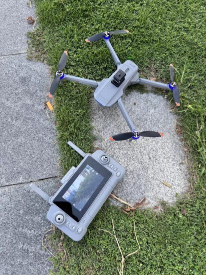




Cinematography & Surveying Aerial Drone Manufacturer | Factory OEM Services
In the dynamic world of aerial imaging, two sectors stand out for their demanding requirements: cinematography (capturing breathtaking visuals for film, TV, and advertising) and surveying (generating precise geospatial data for construction, agriculture, and mining). While both rely on drones, their needs diverge sharply—cinematographers prioritize ultra-high-resolution cameras and silky-smooth stabilization, while surveyors demand centimeter-level accuracy, long endurance, and specialized sensors. As a specialized aerial drone manufacturer focusing on these verticals, we bridge this gap by offering factory OEM services that deliver purpose-built drones for each application. This article explores why cinematography and surveying require distinct drone solutions, how our OEM services cater to both, and why partnering with a dedicated manufacturer ensures unmatched performance and flexibility.
Why Cinematography & Surveying Demand Specialized Aerial Drones
Though both use drones for aerial data capture, cinematography and surveying operate in fundamentally different paradigms:
Cinematography Drones: Art Meets Technology
Filmmakers and content creators need drones that act as “flying cameras,” blending seamlessly into creative workflows. Key demands include:
-
Ultra-High Resolution: 6K/8K video and 24MP+ stills to capture cinematic detail.
-
Stabilization Excellence: 3-axis gimbals with sub-0.01° precision to eliminate shake, even in high winds.
-
Low Noise Operation: Quiet motors to avoid disrupting audio recording on set.
-
Dynamic Flight Modes: “Orbit,” “cable cam,” and “follow-me” modes for automated, repeatable shots.
-
Portability: Foldable designs for easy transport to remote locations.
Surveying Drones: Precision Over Aesthetics
Surveyors and geospatial professionals require drones that function as “flying data collectors,” prioritizing accuracy and efficiency:
-
Centimeter-Level Accuracy: RTK/PPK (Real-Time Kinematic/Post-Processed Kinematic) GPS for sub-5cm positioning.
-
Long Endurance: 60+ minute flight times to cover large areas (100+ hectares) in one sortie.
-
Specialized Payloads: LiDAR, multispectral, or thermal sensors for 3D modeling, crop health analysis, or infrastructure inspection.
-
Ruggedness: Weather-resistant frames (IP55+) to withstand rain, dust, and extreme temperatures.
-
Data Integration: Seamless export to GIS, CAD, or cloud platforms (e.g., ArcGIS, AutoCAD).
A “one-size-fits-all” drone fails both: it lacks the camera quality for cinematography and the precision for surveying. This is where a manufacturer specializing in both verticals and offering OEM services becomes invaluable.
Our Factory OEM Services: Tailored Drones for Cinematography & Surveying
As a dedicated aerial drone manufacturer, we treat OEM (Original Equipment Manufacturing) as a collaborative process—merging your expertise with our engineering prowess to build drones that solve your unique challenges. Here’s how we serve both cinematography and surveying clients:
1. Cinematography Drone OEM: Engineering for Creative Freedom
We design cinematography drones that feel like natural extensions of a filmmaker’s toolkit. Our OEM services include:
Hardware Customization
-
Camera Integration: Mount industry-leading cameras (e.g., RED Komodo, Sony FX6, Blackmagic Pocket Cinema Camera 6K) with custom cooling systems to prevent overheating during long shoots.
-
Gimbal Optimization: 3-axis brushless gimbals with 360° rotation and “infinity” tilt for low-angle or overhead shots.
-
Noise Reduction: Acoustic-dampening materials and low-RPM motors to keep noise below 65dB (quieter than a conversation).
-
Form Factor: Foldable carbon fiber frames (under 2kg) for backpack portability, with modular payload bays to swap cameras quickly.
Software & Workflow Integration
-
Cinematic Flight Modes: Pre-programmed “dolly zoom,” “fly-through,” and “slow orbit” modes, adjustable via a single-tap interface.
-
Live Monitoring: 1080p/4K HDMI output to on-set monitors, with false-color exposure tools for real-time adjustments.
-
Compatibility: SDKs (Software Development Kits) to integrate with popular editing software (Adobe Premiere, DaVinci Resolve) for direct footage transfer.
Example Use Case: A European film production company partnered with us to build a drone with a 6K global-shutter camera and silent flight. The result: seamless aerial shots of a historic castle, with no post-production stabilization needed—cutting editing time by 30%.
2. Surveying Drone OEM: Precision Data Collection, Simplified
For surveyors, our OEM drones are built to deliver accurate, actionable data with minimal operator input. Key offerings:
Payload & Sensor Integration
-
LiDAR Systems: Integrate Velodyne or Livox LiDAR units for 3D point clouds (density: 200pts/m²) and digital elevation models (DEMs).
-
Multispectral Sensors: MicaSense RedEdge or Parrot Sequoia for crop health analysis (NDVI, NDRE indices).
-
Thermal Cameras: FLIR Vue TZ20-R for infrastructure inspections (detecting heat leaks in pipelines) or search-and-rescue.
-
Extended Range: High-gain antennas (20km+ transmission) for remote area mapping.
Positioning & Autonomy
-
RTK/PPK Modules: Dual-frequency GNSS receivers (GPS, GLONASS, Galileo, BeiDou) for <2cm horizontal accuracy.
-
Automated Mission Planning: Software that generates “lawnmower” or “corridor” flight paths based on user-defined boundaries, with obstacle avoidance.
-
Long-Endurance Batteries: 12,000mAh Li-ion packs for 75-minute flight times (fixed-wing models) or 50 minutes (multirotors with heavy payloads).
Example Use Case: A U.S. construction firm used our OEM surveying drone (equipped with LiDAR and RTK) to map a 50-acre site. The drone generated a 3D model in 2 hours—compared to 2 days with ground surveys—accelerating project timelines by 40%.
3. Shared OEM Strengths: Quality, Compliance, & Scalability
Whether building for cinematography or surveying, our factory OEM services share core advantages:
-
In-House R&D: A 15-person team with 10+ years of drone design experience, holding 8 patents in gimbal stabilization and RTK integration.
-
Rigorous Testing: Drones undergo wind tunnel tests (up to 15m/s winds), drop tests (1.5m height), and 100+ flight hours in real-world conditions.
-
Global Compliance: All models meet CE, FCC, and RoHS standards, with optional aviation authority approvals (FAA Part 107, EASA SC-VTOL).
-
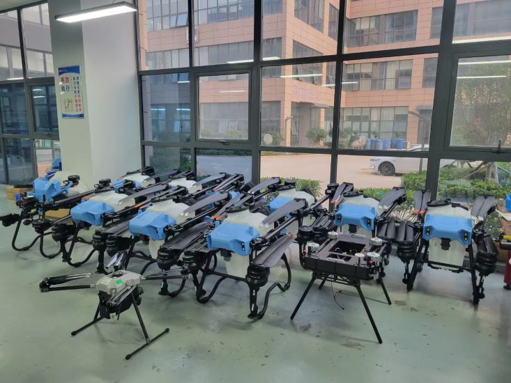
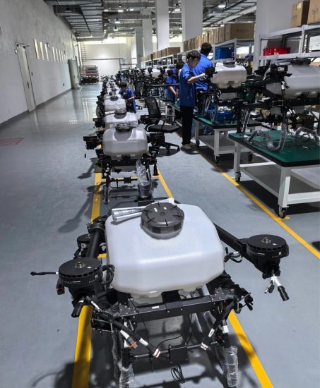
Scalable Production: 3 automated lines producing 15,000 units/month, with MOQs as low as 30 for custom projects.
Applications: Where Our Drones Excel
Our cinematography and surveying drones serve diverse industries, solving niche challenges:
Cinematography Applications
-
Film & TV: Aerial establishing shots, chase sequences, and “bird’s-eye view” transitions.
-
Advertising: Product launches (e.g., cars, yachts) with dynamic camera movements.
-
Events: Concerts, weddings, and sports (e.g., skiing, surfing) with follow-me modes.
-
Tourism: Virtual destination videos for hotels and travel agencies.
Surveying Applications
-
Construction: Site progress monitoring, volumetric calculations (e.g., stockpile measurement).
-
Agriculture: Crop health mapping, irrigation planning, and yield prediction.
-
Mining: Pit wall stability analysis, ore volume estimation.
-
Utilities: Power line/pipeline inspection, vegetation encroachment detection.
How to Choose a Cinematography & Surveying Drone Manufacturer for OEM
Selecting the right partner ensures your OEM drone meets performance and budget goals. Ask these critical questions:
-
Do they have vertical-specific expertise? Look for case studies in both cinematography and surveying—avoid firms that only dabble in one.
-
Can they provide prototypes quickly? A reputable manufacturer delivers functional prototypes in 4–6 weeks for iterative testing.
-
What’s their QC process? Ensure they use ISO 9001-certified production and third-party testing (e.g., SGS for sensor accuracy).
-
Do they support post-launch updates? Firmware upgrades (e.g., new flight modes) and spare parts availability are crucial for long-term use.
Conclusion: Build Your Perfect Aerial Tool with OEM Expertise
In cinematography, the right drone turns ordinary shots into art; in surveying, it transforms days of fieldwork into hours of data collection. As a cinematography & surveying aerial drone manufacturer specializing in factory OEM services, we empower you to build drones that align with your exact needs—whether that’s a silent 8K cinema drone or a rugged LiDAR-equipped mapper.
Our collaborative approach, technical rigor, and scalable production ensure you get a tool that enhances creativity (for filmmakers) or boosts efficiency (for surveyors).
Contact us today to discuss your project, request a prototype, or learn more about our OEM capabilities. Let’s engineer the perfect drone for your mission.
THE END




No comments yet