

How Agricultural Drones Improve Precision Agriculture
Modern agriculture increasingly depends on accurate information, timely field operations, and efficient use of agricultural inputs. As farms become larger and crop-management requirements become more complex, traditional methods alone may not provide the flexibility needed for every field condition.
Agricultural drones can contribute to precision agriculture by combining aerial mobility, digital flight planning, positioning technology, and application equipment in a single platform.
Their role is not limited to spraying or spreading. Depending on the configuration, agricultural UAVs can support crop monitoring, field mapping, targeted application, and other data-driven agricultural tasks.
What Is Precision Agriculture?
Precision agriculture is an approach to farm management that uses information about crops, soil, field conditions, and agricultural operations to make more targeted decisions.
Instead of treating an entire field as if every area has exactly the same requirements, precision agriculture seeks to identify differences within the field.
These differences may involve:
- Crop growth
- Soil conditions
- Water availability
- Pest pressure
- Nutrient requirements
- Terrain
- Plant density
- Field boundaries
Agricultural drones can provide an aerial perspective that helps operators understand these variations.
How Drones Fit Into Precision Agriculture
An agricultural drone can serve several different functions within a precision-farming workflow.
A typical process may include:
Data collection → Field analysis → Operation planning → Targeted application → Monitoring
For example, aerial imagery can help identify areas requiring additional attention. The operator can then plan an agricultural operation based on the available information.
This creates a connection between field observation and physical agricultural work.
Aerial Observation of Agricultural Fields
One advantage of a drone is its ability to view agricultural areas from above.
Aerial images can reveal patterns that may be difficult to identify when walking through a field.
Depending on the equipment, aerial observation can help identify:
- Uneven crop growth
- Gaps in planting
- Areas affected by environmental stress
- Field boundaries
- Standing water
- Vegetation differences
- Changes in crop condition
The usefulness of the imagery depends on image quality, flight planning, environmental conditions, and how the collected information is interpreted.
Field Mapping With Agricultural UAVs
Mapping is another important application.
A drone can follow a planned flight route and collect images of a designated area. These images can then be processed into maps or other geographic information.
Mapping can support:
- Field measurement
- Boundary identification
- Route planning
- Crop monitoring
- Terrain assessment
- Agricultural operation planning
Accurate positioning becomes particularly important when aerial data needs to correspond closely with specific locations in the field.
Targeted Agricultural Applications
Precision agriculture is partly about applying resources where they are needed.
Agricultural drones can support targeted operations by following predefined routes and operating at controlled speeds and altitudes.
For spraying applications, the operator can define parameters such as:
- Flight route
- Flight speed
- Operating altitude
- Application rate
- Spraying width
For granular spreading, additional parameters can include:
- Discharge rate
- Spreading width
- Material characteristics
- Flight speed
The exact level of control depends on the aircraft and software configuration.
Why Accurate Positioning Matters
Positioning technology is central to agricultural drone operations.
A drone needs to know where it is in relation to the planned route and field boundaries.
Accurate positioning can help with:
- Repeated flight paths
- Route planning
- Field boundary management
- Consistent operating height
- Automatic return functions
- Mapping
The positioning system should be selected according to the required level of accuracy and the operating environment.
Flight Planning Can Reduce Unnecessary Movement
A well-planned route can reduce unnecessary flight distance.
For a large field, the system can divide the operating area into planned sections and define appropriate flight paths.
Good route planning can help manage:
- Turning movements
- Obstacles
- Field boundaries
- Battery limitations
- Refill locations
- No-entry areas
This becomes increasingly important as field size increases.
Agricultural Drones and Input Efficiency
Agricultural inputs can represent a significant operating cost.
The objective of precision application is not simply to use less material. It is to apply an appropriate amount in the appropriate location and at the appropriate time.
A drone can provide controlled application parameters, but actual input efficiency depends on many factors.
These include:
- Application rate
- Crop condition
- Material characteristics
- Weather
- Flight speed
- Spray or spreading system
- Operator settings
The drone is therefore one component of a larger precision-agriculture system.
Weather Still Matters
Advanced flight control does not eliminate environmental limitations.
Wind, temperature, humidity, and rainfall can affect agricultural operations.
For spraying, wind can influence droplet movement and deposition.
For granular spreading, wind can affect distribution patterns.
Operators should therefore evaluate weather conditions before and during agricultural operations and follow applicable product and safety requirements.
Precision Spraying With Agricultural Drones
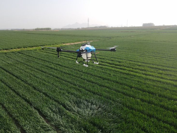
Liquid spraying is one of the most widely discussed applications of agricultural UAVs.
A spraying system normally includes a tank, pump, pipes, filters, valves, and nozzles.
The operator can configure parameters according to the intended application.
Important variables include:
- Application rate
- Flight speed
- Spray width
- Flight altitude
- Nozzle configuration
- Liquid characteristics
Consistent operation requires the spraying system to be properly maintained and calibrated.
Precision Fertilizer Spreading
Agricultural drones can also be equipped with spreading systems for suitable granular materials.
Instead of liquid nozzles, a spreading drone generally uses a hopper and mechanical distribution system.
Application performance depends on:
- Hopper capacity
- Discharge rate
- Material density
- Particle size
- Spreading width
- Flight speed
- Wind
Calibration is particularly important because different granular materials can behave differently during distribution.
Using Drones for Crop Monitoring
Precision agriculture requires repeated observation rather than a single inspection.
Drone flights can be scheduled at different stages of crop development to observe changes over time.
Repeated aerial observations can help operators compare:
- Early crop development
- Mid-season growth
- Areas with uneven development
- Changes after agricultural treatment
- Pre-harvest conditions
A consistent flight plan can make comparisons more useful.
Combining Data With Field Operations
The real value of agricultural drones can come from combining information with action.
For example:
Step 1: Collect aerial information.
Step 2: Identify areas requiring attention.
Step 3: Plan the appropriate agricultural operation.
Step 4: Use the drone to perform the selected application.
Step 5: Monitor the field again.
This creates a continuous operational cycle rather than treating aerial imaging and spraying as completely separate activities.
Challenges of Using Agricultural Drones
Agricultural drones also have limitations.
Operators need to consider:
- Battery endurance
- Payload limitations
- Weather conditions
- Field obstacles
- Regulations
- Operator training
- Maintenance
- Data-processing requirements
- Charging infrastructure
Large agricultural operations may also need multiple aircraft, batteries, operators, and support equipment.
Understanding these limitations is important when planning a commercial drone program.
What Farmers Should Consider Before Adopting Drone Technology
Before purchasing an agricultural UAV, farmers should define their actual requirements.
Useful questions include:
- What crops will be monitored or treated?
- How large is the operating area?
- What type of terrain is involved?
- Is spraying, spreading, mapping, or monitoring the primary purpose?
- How frequently will the drone be used?
- What payload is required?
- What battery infrastructure is available?
- What local regulations apply?
- Who will operate and maintain the equipment?
- What technical support is available?
The answers can help determine whether a small, medium, or higher-capacity platform is appropriate.
Agricultural Drones for Commercial Service Providers
Agricultural service companies have different requirements from individual farms.
A commercial operator may need equipment capable of working across multiple farms and crop types.
Important considerations can include:
- Daily operating capacity
- Battery management
- Fast refilling
- Spare parts
- Transportation
- Multiple aircraft
- Operator training
- Technical support
A scalable equipment system can make it easier to expand agricultural services as demand increases.
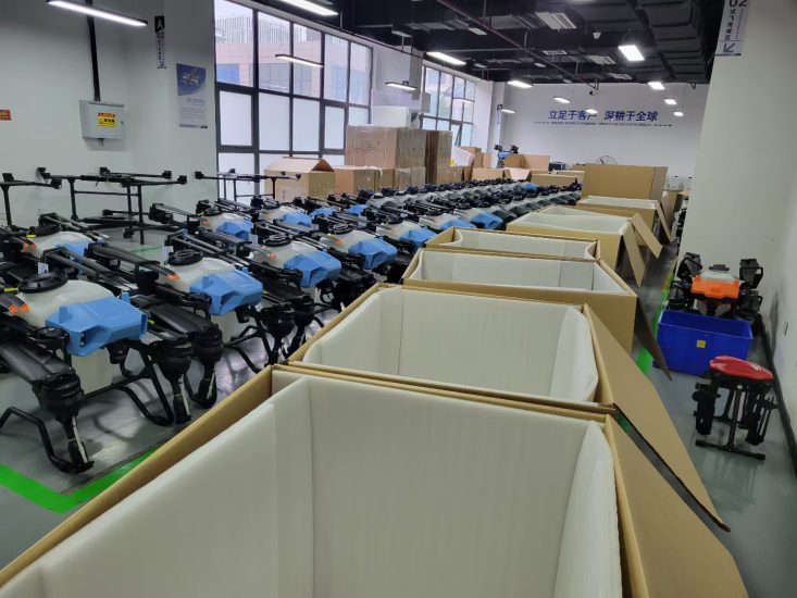
The Role of OEM and ODM Manufacturing
Different agricultural markets can have different requirements.
A distributor may need a particular payload, battery configuration, spreading system, packaging format, or product branding.
OEM and ODM manufacturing can provide opportunities to develop configurations for specific markets.
Possible customization areas include:
- Aircraft appearance
- Product branding
- Packaging
- Tank capacity
- Hopper configuration
- Spraying system
- Spreading system
- Controller interface
- Accessories
- Documentation
The feasibility of each customization depends on the technical platform and project requirements.
Frequently Asked Questions
Can agricultural drones improve precision farming?
They can support precision agriculture through aerial observation, mapping, route planning, and controlled agricultural applications. The overall result also depends on data quality, operating conditions, and farm-management practices.
Can one drone perform both spraying and spreading?
Some UAV platforms can support different application modules, but compatibility depends on the aircraft design and available equipment.
Are drones useful for large farms?
They can be useful for large agricultural areas, particularly when aerial access, route planning, and application flexibility provide practical advantages.
Does precision agriculture mean using less fertilizer or pesticide?
Not necessarily. The objective is to make agricultural applications more targeted and appropriate to field conditions. Actual input use depends on crop requirements and agricultural management decisions.
Do agricultural drones require trained operators?
Yes. Operators should understand the aircraft, flight procedures, application equipment, safety requirements, and applicable local regulations.
The Future of Agricultural UAV Applications
Agricultural drones are becoming part of a broader digital farming workflow that connects aerial observation, field mapping, flight planning, and agricultural application.
The technology is most useful when it solves a specific operational problem rather than being adopted simply because it is new.
For farmers and agricultural service providers, the key is to match the aircraft, payload, application system, software, and workflow to actual field requirements.
MSOEN develops agricultural UAV solutions for spraying, spreading, mapping, and other agricultural applications, with configurations that can be discussed according to crop type, operating environment, payload requirements, and commercial use.



No comments yet