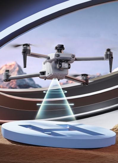




The modern highway system, a lifeline of global commerce and mobility, faces relentless challenges from aging infrastructure, extreme weather, and escalating traffic demands. Traditional inspection methods—reliant on ground crews, bucket trucks, and occasional helicopter surveys—are increasingly inadequate. They are slow, costly, labor-intensive, and often hazardous. Enter the highway inspection drone: an agile, sensor-laden aerial platform poised to transform how we monitor, assess, and maintain our critical road networks. This article explores the technological underpinnings, diverse applications, operational advantages, and future trajectory of drones in revolutionizing highway infrastructure management.
The Imperative for Change: Limitations of Conventional Methods
Current highway inspection practices suffer from significant drawbacks:
-
High Costs & Resource Intensity: Mobilizing specialized vehicles, safety teams, and personnel for extensive visual inspections or detailed structural assessments (e.g., bridge decks) consumes substantial financial and human resources.
-
Safety Risks: Inspectors working near high-speed traffic or at height (bridges, overpasses) face inherent dangers. Adverse weather conditions further amplify these risks.
-
Limited Access & Perspective: Ground-based views are constrained by terrain, vegetation, and physical barriers. Helicopters offer aerial views but are expensive, noisy, and provide limited low-altitude detail.
-
Infrequency & Inefficiency: Scheduling comprehensive inspections is complex, often leading to infrequent assessments. Data collection can be slow, and analysis is frequently manual and time-consuming.
-
Incomplete Data: Visual inspections alone may miss subsurface defects, internal structural issues, or subtle surface degradations until they become critical.
These limitations necessitate a paradigm shift towards more efficient, safer, and data-rich inspection methodologies.
The Drone Solution: A Multi-Faceted Aerial Platform
Drones, or Unmanned Aircraft Systems (UAS), offer a compelling alternative. Equipped with advanced sensors and intelligent software, they function as versatile data-gathering nodes capable of operating in complex environments. Key components enabling their effectiveness include:
-
Aerial Agility & Accessibility: Drones can navigate tight spaces, fly close to structures, and access difficult-to-reach areas (e.g., steep embankments, underneath bridges) far more easily and safely than ground teams or helicopters. They operate effectively in diverse weather conditions (within limits).
-
Advanced Sensor Suites: Modern inspection drones carry a variety of payloads:
-
High-Resolution RGB Cameras: Capture detailed visual imagery for assessing pavement condition (cracks, potholes, rutting), signage integrity, guardrail damage, and general asset appearance.
-
Thermal (Infrared) Sensors: Detect heat signatures indicative of subsurface moisture ingress in pavements, electrical faults in lighting/signals, or distressed concrete emitting anomalous thermal patterns. Crucial for identifying delamination or voids beneath surfaces.
-
LiDAR (Light Detection and Ranging): Generates precise 3D point clouds of infrastructure geometry. Essential for monitoring bridge deformations, slope stability, stockpile volumes, and creating accurate digital twins of assets.
-
Multispectral/Hyperspectral Sensors: Analyze reflected light across specific wavelengths to detect vegetation stress (potential root intrusion near foundations), material composition variations, or chemical spills.
-
Gas/Smoke Detectors: Deployed for post-accident assessment or monitoring tunnel safety.
-
-
Real-Time Data Transmission & Processing: Onboard computing and reliable communication links enable near real-time streaming of high-bandwidth sensor data (especially video and LiDAR scans) to ground control stations. Cloud-based platforms facilitate rapid processing, analysis, and storage.
-
Autonomous Flight Capabilities: Pre-programmed flight paths (waypoint navigation) allow for consistent, repeatable data collection missions, minimizing operator workload and ensuring full coverage of designated areas. AI-powered obstacle avoidance enhances safety.
-
Integration with GIS/Mapping Software: Collected georeferenced data (imagery, point clouds) can be seamlessly integrated into Geographic Information Systems (GIS) for spatial analysis, change detection over time, and overlay with other infrastructure layers.
Transformative Applications Across the Highway Lifecycle
The deployment of drones spans the entire spectrum of highway management:
-
Routine Pavement Condition Assessment:
-
Crack Detection: High-res cameras combined with AI algorithms automatically identify and quantify cracks (length, width, density), mapping distress across vast road segments far faster and more consistently than manual surveys.
-
Surface Anomaly Identification: Drones rapidly survey for potholes, rutting, raveling, and patching failures, providing objective data for prioritizing maintenance.
-
Pavement Marking Evaluation: Assess the visibility and condition of lane markings, reflectors, and symbols.
-
-
Bridge and Structural Inspection:
-
Exterior Surfaces: Detailed visual and thermal scans of superstructures, substructures, bearings, and expansion joints reveal spalling, corrosion, efflorescence, and potential water leaks.
-
Underside Inspection: Drones easily access and inspect hard-to-reach areas like bridge soffits, piers, and abutments, detecting cracks, corrosion, and debris blockages.
-
Deformation Monitoring: Repeat LiDAR surveys track minute changes in bridge geometry over time, indicating potential settlement or structural movement.
-
Post-Earthquake/Disaster Assessment: Rapidly deployable drones provide initial damage assessment, identifying critical failures and safe passage routes.
-
-
Right-of-Way and Asset Management:
-
Vegetation Control: Multispectral sensors map vegetation health and density, identifying invasive species or overgrowth encroaching on clear zones or drainage systems.
-
Signage and Lighting Inventory: Catalog the location, type, and condition of signs, signals, and luminaires.
-
Guardrail and Barrier Integrity: Check for damage, misalignment, or end-treatment issues.
-
Ditch and Drainage Inspection: Identify blockages, erosion, or structural problems in culverts and ditches.
-
-
Construction and Maintenance Support:
-
Progress Monitoring: Provide regular aerial updates of construction sites, comparing progress against plans.
-
Volume Measurement: Use LiDAR or photogrammetry to accurately calculate earthwork quantities, stockpile volumes, and material usage.
-
Work Zone Safety Oversight: Monitor compliance with safety protocols and traffic control measures.
-
As-Built Verification: Capture final site conditions for accurate documentation.
-
-
Incident Response and Emergency Management:
-
Rapid Damage Assessment: Quickly survey accident scenes, landslides, floods, or storm damage to assess impact, identify hazards, and plan recovery efforts.
-
Traffic Flow Analysis: Monitor congestion and rerouting effectiveness post-incident.
-
Hazardous Material Detection: Equipped sensors can help identify spill types and extents.
-
Tangible Benefits: Efficiency, Safety, and Insight
The adoption of drone technology yields significant advantages:
-
Enhanced Safety: Dramatically reduces the need for inspectors to work in active traffic lanes or at dangerous heights, minimizing exposure to accidents and environmental hazards.
-
Increased Efficiency & Speed: Cover large areas rapidly (km/h vs. km/day for ground teams), enabling more frequent inspections and faster data acquisition. Automated analysis accelerates reporting.
-
Cost Reduction: Lowers expenses associated with mobilization, specialized vehicles, personnel hours, and traffic management during inspections. Operational costs per kilometer surveyed are significantly lower than traditional methods.
-
Superior Data Quality & Richness: Provides consistent, high-resolution, georeferenced data from multiple perspectives (including hard-to-see angles). Enables quantitative analysis (e.g., crack measurement, volume calculation) impossible with unaided visual inspection.
-
Improved Decision-Making: Delivers actionable insights through data analytics and visualization tools, allowing agencies to prioritize repairs based on objective condition data, optimize maintenance schedules, and extend asset life.
-
Minimal Disruption: Inspections can often be conducted without lane closures, reducing traffic delays and associated economic and social costs.
Navigating Challenges: Implementation Considerations
Despite the clear benefits, successful integration requires addressing several challenges:
-
Regulatory Compliance: Adherence to aviation regulations (e.g., FAA Part 107 in the US, EASA regulations in Europe) regarding flight operations, airspace authorization (especially near airports), pilot certification, and Remote ID is mandatory.
-
Airspace Integration: Safely operating drones in complex airspaces shared with manned aircraft requires robust procedures, communication, and potentially technologies like Detect-and-Avoid (DAA).
-
Data Management & Security: Handling, storing, processing, and securing vast amounts of sensitive data requires significant IT infrastructure and cybersecurity measures.
-
Specialized Training: Pilots require training not only in flying skills but also in mission planning, emergency procedures, sensor operation, and data handling. Analysts need expertise in interpreting sensor outputs and using specialized software.
-
Environmental Factors: Wind, rain, fog, and extreme temperatures can limit flight operations and sensor performance.
-
Public Perception & Privacy: Addressing concerns about noise, privacy invasion (capturing images of private property), and potential misuse is important for community acceptance. Clear policies and communication are key.
-
Initial Investment: While operational savings are significant, upfront costs for hardware, software, training, and regulatory compliance exist.
The Future Trajectory: Smarter, More Autonomous, Integrated
The evolution of highway inspection drones is accelerating, driven by technological advancements:
-
AI-Powered Autonomy: Increased reliance on artificial intelligence for fully autonomous flight planning, adaptive mission execution (reacting to detected anomalies), and sophisticated data analysis (e.g., automated defect classification, predictive maintenance models).
-
Swarm Technology: Coordinated fleets of drones working collaboratively to cover extremely large areas or perform complex multi-sensor tasks simultaneously, enhancing efficiency.
-
Advanced Sensor Fusion: Combining data from multiple sensors (e.g., LiDAR + Thermal + Hyperspectral) on a single platform or correlating data from different drones to create richer, more comprehensive understanding of asset condition.
-
Edge Computing: Performing more data processing directly onboard the drone, reducing latency and bandwidth requirements for real-time analysis.
-
Integration with Other Technologies: Seamless fusion of drone data with other sources like fixed sensors (strain gauges, accelerometers on bridges), satellite imagery, and vehicle-mounted mobile sensors (probes) for a holistic view.
-
Digital Twins: Using drone-derived 3D models and sensor data to create dynamic, evolving digital replicas of highway assets, enabling simulation, predictive analysis, and lifecycle management.
-
Beyond Visual Line of Sight (BVLOS) Operations: Regulatory evolution and technological safeguards (like detect-and-avoid systems) will enable longer-range, more efficient missions without constant direct pilot observation, unlocking greater potential.
Conclusion: A New Era of Proactive Infrastructure Stewardship
The highway inspection drone represents a fundamental shift from reactive, labor-intensive, and often incomplete assessments to proactive, data-driven, and highly efficient infrastructure management. By providing unprecedented access, rich data streams, and enhanced safety, drones empower transportation agencies to move beyond merely patching problems to truly understanding and predicting the health of their vital road networks. While challenges related to regulation, integration, and cost remain, the trajectory is clear. As technology matures, autonomy increases, and regulatory frameworks adapt, drones will become an indispensable tool in the arsenal of modern civil engineering. They are not just flying cameras; they are the aerial guardians enabling a future of safer, more resilient, and efficiently maintained highways for generations to come. The integration of this technology marks the dawn of a new era in infrastructure stewardship, where data from above guides intelligent decisions on the ground.
THE END


No comments yet