




Introduction: The Geography of Challenge
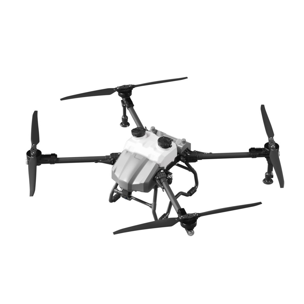
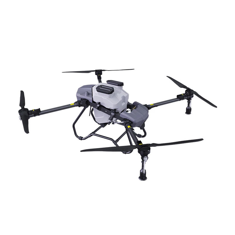
For centuries, mountain orchardists have been prisoners of geography. While flatland agriculture has benefited from tractors, sprayers, and eventually drones, steep-slope farming remained stubbornly manual, dangerous, and inefficient. The 45-degree slopes of tea plantations in Asia, the terraced citrus groves of the Mediterranean, and the coffee estates of South America present an almost impossible challenge for traditional machinery. However, the advent of the Fully Autonomous Mountain Orchard Drone, equipped with Terrain-Following Radar and 45° Slope Stability, is shattering these limitations. This article explores the technological breakthroughs and agronomic impacts of deploying aerial robotics in the world’s most challenging agricultural environments.
Chapter 1: The Physics of Slope Flight
Flying a drone on a flat field is a relatively simple balancing act. Flying on a 45-degree slope is a constant battle against gravity and aerodynamic instability.
1.1 Aerodynamic Challenges
On a steep incline, the relative wind direction changes constantly. A standard drone trying to maintain a fixed altitude above a slope will struggle; as it moves uphill, the ground rises faster than the drone can climb, risking a collision. As it moves downhill, it may gain altitude too quickly, losing spray coverage. The 45° stable drone utilizes advanced flight controllers capable of interpreting pitch and roll angles in real-time, adjusting motor RPM instantly to maintain a consistent trajectory parallel to the slope.
1.2 Center of Gravity (CoG) Management
Traditional drones have a symmetrical design. Slope-specific models feature a slightly forward-shifted center of gravity. This design counteracts the natural tendency to slide backward down a hill when hovering, allowing for more efficient forward flight and reducing the energy expenditure required to fight gravity.
Chapter 2: Terrain-Following Radar – The Sixth Sense
The core technology enabling this revolution is high-frequency terrain-following radar. Unlike visual sensors that fail in fog, rain, or darkness, radar penetrates all conditions.
2.1 How It Works
The radar emits microwave signals that bounce off the canopy below. By measuring the time it takes for these signals to return, the drone calculates its exact height above the crop. This happens hundreds of times per second. The flight controller uses this data to adjust the throttle, ensuring the drone maintains a constant, predetermined distance (e.g., 2 meters) from the treetops, regardless of whether it is flying over a valley floor or climbing a ridge.
2.2 Canopy Penetration and Spray Efficacy
In orchards, the goal is not to spray the top of the trees, but to penetrate the canopy to reach the fruit-bearing interior. By maintaining a precise, low altitude via radar, the drone’s rotor wash acts as a forced-air system. This pushes the micron-sized droplets through the dense foliage, ensuring coverage on the underside of leaves—a critical factor in controlling pests like aphids and mites that hide from the sun.
Chapter 3: The 45° Threshold – Engineering for Extremes
Why is 45 degrees the benchmark? It represents the approximate angle of repose for loose soil and the maximum gradient where humans can still safely stand and work.
3.1 Propulsion and Thrust-to-Weight Ratio
To hover on a 45-degree slope, a drone must generate significantly more thrust than required for level flight. Engineers achieve this by pairing high-KV (velocity constant) motors with large-diameter propellers. This configuration generates immense lift, allowing the drone to “lean into” the slope like a rock climber, maintaining position even in strong crosswinds common in mountainous regions.
3.2 Battery and Power Management
Flying on slopes consumes more power. A 45° flight requires approximately 30% more battery capacity than flat flight. Therefore, these drones feature optimized power systems that minimize resistive losses and high-discharge lithium batteries capable of delivering sustained peak power without voltage sag.
Chapter 4: Autonomous Flight in Complex Topography
Manual flight in mountain orchards is stressful and imprecise. The true value lies in full autonomy.
4.1 3D Mapping and Path Planning
Before spraying, the operator walks the perimeter of the orchard with a remote controller, or uses the drone to perform a rapid 3D scan. The software generates a topographic map, identifying elevation changes and obstacles. It then creates a flight path that follows the contour of the land, ensuring that every row of trees, no matter how winding, receives identical treatment.
4.2 Obstacle Avoidance in 3D Space
Mountain orchards are filled with hazards: power lines strung between poles, tall trees at plot boundaries, and irrigation pipes. Autonomous drones integrate binocular vision and omnidirectional radar. Unlike flatland drones that only look forward, these systems monitor the entire flight envelope, executing evasive maneuvers to fly around obstacles while staying on the designated slope-following path.
Chapter 5: Case Study – The Citrus Terraces
Imagine a steep citrus orchard built into the side of a mountain.
5.1 The Traditional Method
Workers carry heavy backpack sprayers weighing 20kg up slippery terraces. They struggle to reach the upper canopy of tall trees. The work is slow, dangerous (risk of falling), and exposure to chemicals is high. Coverage is inconsistent, leading to pest outbreaks and fruit drop.
5.2 The Drone Solution
The autonomous drone takes off from a flat landing pad at the bottom. It ascends the slope at a 45-degree angle, flying just 2 meters above the tree canopy. It follows the contour of the terrace, spraying each row with perfect uniformity. In the time it took a worker to spray one row, the drone completes twenty. There is no chemical exposure to the operator, and no risk of slipping on wet terraces.
Chapter 6: Crop-Specific Applications
6.1 Tea Plantations
Tea requires frequent foliar feeding and pest control. The drone’s gentle downwash is perfect for the delicate tea leaves. The terrain-following capability ensures that even on the steepest slopes, the spray hits the new flush (the tender leaves) effectively.
6.2 Coffee Estates
Coffee cherries grow on bushes that require even coverage for fungal disease prevention (like coffee rust). The 45° stability allows the drone to navigate the uneven, rocky terrain of high-altitude coffee farms where wheeled vehicles cannot go.
6.3 Stone Fruit and Nuts
Orchards for apples, peaches, and walnuts are often on hilly terrain. These crops require precise timing for calcium sprays and thinning agents. The drone ensures that applications are made exactly when needed, regardless of how inaccessible the terrain is after a rainstorm.
Chapter 7: Maintenance in Harsh Environments
Mountain environments are punishing on electronics.
7.1 Corrosion and Moisture
High altitudes often mean high humidity and acidic fruit tree sprays. The drone’s motors use sealed bearings and stainless-steel shafts. The electronic speed controllers (ESCs) are encased in potting compound to protect against moisture ingress.
7.2 Propeller and Arm Durability
Flying close to trees increases the risk of blade strikes. The propellers are made from flexible, high-impact composite plastics that bend rather than snap upon light contact. The arms are constructed from carbon fiber tubes that can absorb vibrations from rough landings on uneven ground.
Chapter 8: Economic Impact and Labor Shift
The introduction of slope drones is causing a fundamental shift in the economics of mountain farming.
8.1 Solving Labor Shortages
Younger generations are unwilling to perform the dangerous, back-breaking work of manual spraying on mountainsides. Drones allow the aging farming population to maintain productivity without physical strain. One person can now manage the spraying of a hillside that previously required five laborers.
8.2 Yield Improvement
Consistent, timely spraying leads to healthier trees and higher yields. For a mountain orchardist, a 10% increase in yield due to better pest control can be the difference between profit and bankruptcy. The drone pays for itself through increased production and reduced chemical waste.
Chapter 9: The Future of Mountain Agri-Tech
The terrain-following drone is the first step toward fully automated mountain farming.
9.1 Multispectral Monitoring
Future iterations will carry multispectral cameras. These sensors can detect water stress or nutrient deficiencies in specific sections of a slope. The drone can then return to perform a targeted “precision spray” only on the areas that need it, further reducing chemical use.
9.2 Swarm Deployment
In the near future, a single operator will manage a swarm of three or four drones. As one drone lands to swap batteries, another takes its place in the air. This continuous operation will allow even the largest mountain estates to be managed with unprecedented speed.
Conclusion: Leveling the Playing Field
Geography should not dictate productivity. The Fully Autonomous Mountain Orchard Drone with 45° Slope Stability and Terrain-Following Radar is leveling the playing field for farmers trapped on difficult land. It transforms a dangerous, labor-intensive chore into a safe, automated, and highly efficient process. For the orchardist looking at a steep hillside, the message is clear: the vertical frontier is no longer a barrier—it is the next great opportunity for growth.
THE END



No comments yet