

The proliferation of Unmanned Aerial Vehicles (UAVs) has transformed from a hobbyist pastime into a sophisticated domain of computer science and engineering. For high school students, the world of autonomous drones often appears shrouded in complex mathematics and obscure hardware. This paper aims to demystify this technology by breaking down the MSOEN architecture—Mission planning, Sensor fusion, Obstacle avoidance, Environmental mapping, and Network communication. By providing a professional yet accessible analysis of the algorithms and hardware that constitute an autonomous system, we empower educators to teach the “Intelligent Navigator” framework. This guide serves as a bridge between theoretical STEM education and practical, industry-standard drone technology, proving that advanced autonomy is not just for PhDs, but is achievable for high school minds.
1. Introduction: The Age of the Intelligent Navigator
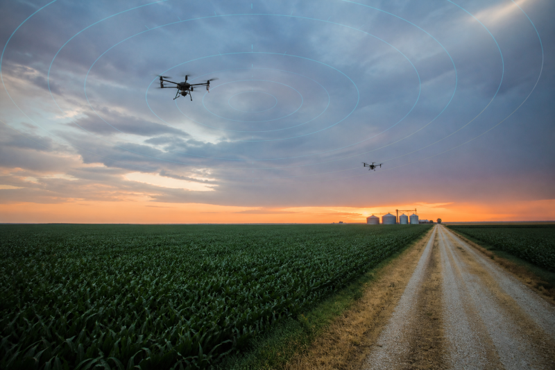
In the past decade, the word “drone” has evolved from a science fiction trope to a household gadget. However, in educational settings, the focus has often remained on the most basic aspect of this technology: remote control. Students learn to pilot drones using a Radio Control (RC) transmitter, developing hand-eye coordination but gaining little insight into the “brain” of the machine. The true potential of drone education lies in Autonomy. An autonomous drone is a robot. It senses its environment, processes data, and makes decisions without human intervention.
To make this complex topic accessible to high school students, we utilize the MSOEN framework. MSOEN is an acronym that breaks the autonomous flight stack into five digestible, interconnected pillars: Mission, Sensor fusion, Obstacle avoidance, Environmental mapping, and Network. By analyzing the specific hardware and algorithms associated with each pillar, we can construct a curriculum that is both rigorous and comprehensible. This paper provides a detailed, professional analysis of these components, acting as a blueprint for the next generation of student engineers.
2. The Hardware Ecosystem: The Physical Body of Autonomy
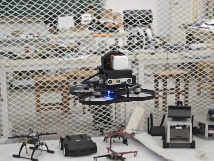
Before a student can write a single line of code, they must understand the physical machine that will execute their commands. An autonomous drone is a symphony of hardware components, each with a specific role in the MSOEN architecture.
-
The Flight Controller (The Brain Stem): At the heart of every autonomous drone is a flight controller, such as the Pixhawk series. This is a specialized microcontroller running a Real-Time Operating System (RTOS). Its primary job is to read sensor data and adjust motor speeds hundreds of times per second to maintain stable flight. It is the “reflex” center. For high school students, understanding the flight controller is akin to understanding the brainstem—it handles the vital, unconscious functions that keep the system alive.
-
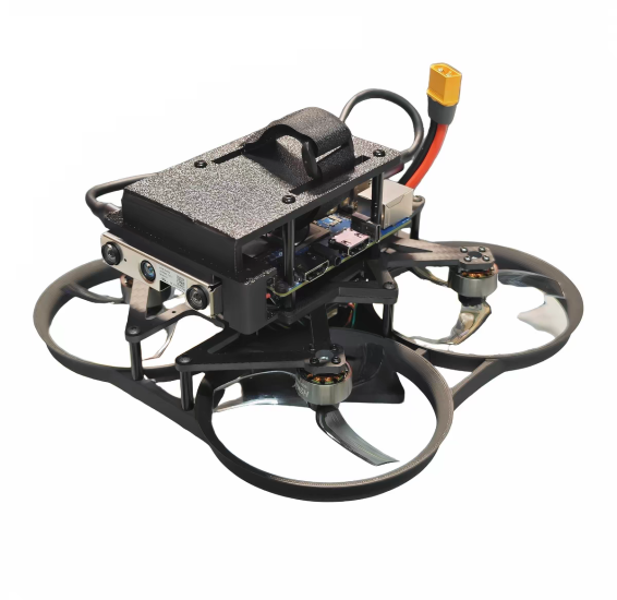
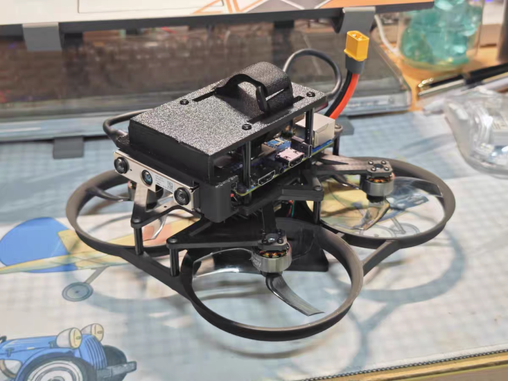
The Companion Computer (The Cortex): While the flight controller handles stability, the “Intelligent Navigator” logic (the MSOEN algorithms) requires more processing power. This is where a Companion Computer, like the Raspberry Pi 4 or the NVIDIA Jetson Nano, comes in. This is a full-fledged Linux computer that runs high-level code in Python or C++. It communicates with the flight controller via a serial connection using the MAVLink protocol. Students learn that the Companion Computer is the “mind,” making decisions, while the flight controller is the “body,” executing movements.
-
The Sensors (The Sensory Organs): A drone perceives the world through sensors. The GPS provides global coordinates. The IMU (Inertial Measurement Unit), consisting of accelerometers and gyroscopes, measures acceleration and rotation. The Magnetometer acts as a compass. Barometers measure altitude. For obstacle avoidance and mapping, LiDAR (Light Detection and Ranging) and Stereo Cameras (like the Intel RealSense) provide depth perception. Teaching students about these sensors is teaching them about the “five senses” of the robot.
3. Mission (M): The Logic of Flight
The “Mission” pillar defines the “What” and “Why” of the flight. It is the strategic layer of the MSOEN framework.
-
The Algorithm: State Machines. At its core, a mission is a sequence of states and transitions. In computer science, this is modeled as a Finite State Machine (FSM). For a high school student, this is simply a flowchart. The drone might have states like
IDLE,TAKEOFF,CRUISE,AVOID, andLAND. The transition fromTAKEOFFtoCRUISEoccurs when the altitude sensor reports a value greater than 10 meters. Students learn to code these logic structures, understanding that autonomy is not random; it is a series of “If-Then” statements executed with precision. -
Waypoint Navigation. A mission is often defined by a series of GPS coordinates, or “Waypoints.” The algorithm must calculate the bearing and distance between these points. Using the Haversine formula, students can learn how to calculate the shortest path between two points on the Earth’s spherical surface. This brings high school geometry and trigonometry to life.
4. Sensor Fusion (S): The Art of Certainty
No single sensor is perfect. GPS signals can be lost, and accelerometers can drift over time. Sensor Fusion is the algorithmic process of combining data from multiple sensors to produce a more accurate, reliable estimate of the drone’s state.
-
The Algorithm: The Kalman Filter. The most common algorithm for sensor fusion in drones is the Extended Kalman Filter (EKF). To explain this to high school students, we use the analogy of a “Team of Experts.” Imagine you are trying to guess your location. You ask a GPS expert and a Dead-Reckoning expert (who tracks movement from the IMU). The GPS expert is usually right but sometimes hallucinates. The Dead-Reckoning expert is smooth but slowly drifts away from the truth. The Kalman Filter is the “Manager” who listens to both, weighs their reliability, and produces a final, best guess. Mathematically, it involves predicting a state and then updating that prediction based on new measurements, minimizing the variance of the error.
-
Hardware Interaction. The EKF runs on the flight controller, processing data from the IMU, GPS, and magnetometer. When students tune the “Noise Parameters” of the EKF, they are essentially telling the algorithm how much to trust each sensor. This is a powerful lesson in data reliability and statistics.
5. Obstacle Avoidance (O): The Reflex of Survival
Once the drone knows where it is and where it wants to go, it must ensure it survives the journey. Obstacle Avoidance is the reactive layer that prevents collisions.
-
The Algorithm: Vector Field Histograms (VFH). While simple drones might just “stop” when they see an obstacle, an Intelligent Navigator must navigate around it. The VFH algorithm converts sensor data (like a LiDAR scan) into a polar histogram. It then identifies “valleys” (spaces with no obstacles) and steers the drone toward the valley that is closest to the target direction. Another approach is Artificial Potential Fields, where the target is an attractive force and obstacles are repulsive forces. The drone calculates the vector sum of these forces to determine its path.
-
Hardware Interaction. This pillar relies heavily on Stereo Vision or 360-degree LiDAR. These sensors provide the “point cloud” data necessary for the algorithms. Students learn to interface these sensors with the Companion Computer, processing the data in real-time to adjust the flight path. This is where computer vision (using OpenCV) meets robotics.
6. Environmental Mapping (E): Building the World
For a drone to operate in unknown environments, it must build a map. This is the realm of SLAM (Simultaneous Localization and Mapping).
-
The Algorithm: Occupancy Grid Mapping. For high school students, SLAM can be simplified into an Occupancy Grid. The environment is divided into a grid of square cells. As the drone moves and senses, it updates the probability of each cell being occupied. If the LiDAR beam hits something in cell (5,5), that cell’s “occupied” probability increases. Over time, the drone builds a 2D map of its surroundings.
-
Hardware Interaction. SLAM requires a constant stream of sensor data and movement data (Odometry). The flight controller provides the Odometry, while a 2D LiDAR provides the distance measurements. The Companion Computer crunches the numbers to generate the map. Students can visualize this map on a Ground Control Station (GCS) like QGroundControl, watching the “fog of war” lift as the drone explores.
7. Network (N): The Thread of Communication
An autonomous system is rarely isolated. The Network pillar handles the communication between the drone and the ground, as well as the security and reliability of that data.
-
The Algorithm: MAVLink and Telemetry. MAVLink (Micro Air Vehicle Link) is the dominant protocol for drone communication. It is a binary protocol that defines how messages (like “Battery Voltage” or “GPS Coordinates”) are packaged and transmitted. Students learn about “packets,” “bandwidth,” and “latency.” They also learn about “Heartbeats”—small packets sent every second to confirm the connection is alive. If the heartbeat is lost, the drone must execute a “Fail-safe” procedure, such as returning to home.
-
Hardware Interaction. Telemetry radios (e.g., SiK radios) or Wi-Fi modules are used to transmit data. Students set up these networks, learning about frequency bands (915MHz vs 2.4GHz) and the importance of antenna placement. Furthermore, they explore basic cybersecurity, learning how to encrypt their MAVLink streams to prevent “spoofing” or “man-in-the-middle” attacks.
8. Bringing MSOEN to the High School Classroom
Teaching these complex topics requires a structured, project-based approach. The “Sandwich” method is highly effective:
-
Simulation (The Digital Twin): Using Gazebo or AirSim, students write Python code to control a virtual drone. They can crash it a thousand times without cost, learning the MSOEN logic in a safe environment.
-
Hardware Integration (The Workbench): Students assemble the physical drone, connecting the Pixhawk, Raspberry Pi, and sensors. They learn about voltage, current, and soldering.
-
The Flight Lab (The Validation): Finally, students upload their code to the physical drone. They conduct missions, testing their algorithms in the real world.
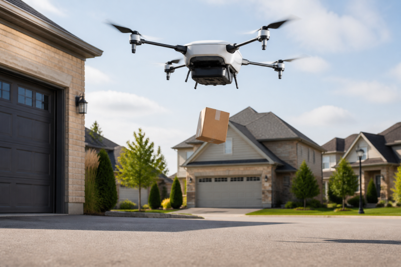
A capstone project, such as the “Autonomous Package Delivery,” requires students to integrate all five MSOEN pillars. They must plan a mission, fuse sensor data for stable flight, avoid obstacles, map the delivery area, and maintain network communication.
9. Conclusion: The Navigator Within
The MSOEN framework provides a comprehensive map for navigating the complex world of autonomous drones. By breaking down the hardware and algorithms into these five pillars—Mission, Sensor fusion, Obstacle avoidance, Environmental mapping, and Network—we make the “Intelligent Navigator” accessible to high school students. This approach transforms abstract STEM concepts into tangible, flying realities. It teaches students that they are not just passengers in the technological revolution; they are the pilots, the engineers, and the architects of the future. The sky is no longer the limit; it is the classroom.
THE END


No comments yet