




For years, industrial drones were viewed as high-tech luxuries reserved for elite tech firms or heavily funded government projects. Today, the landscape has completely shifted. Tightly integrated drone manufacturing hubs have turned commercial unmanned aerial vehicles (UAVs) into highly accessible, cost-effective machinery capable of completely revolutionizing traditional workflows.
However, moving from manual labor to drone automation introduces a major challenge: how do you pick the right platform without over-engineering your solution? Buying a mapping drone for a basic security inspection job—or using a standard video drone to count crops—wastes budget and delivers poor operational efficiency.
This guide breaks down the three dominant pillars of enterprise drone technology, helping you align the correct hardware with your specific business pain points.
The Three Pillars of Enterprise Drone Integration
1. Agricultural & Precision Crop Care (Spraying / Spreading)
- The Business Pain Point: Manual crop spraying is slow, exposes workers to toxic chemicals, and results in uneven application. Traditional tractors damage crops during field transit.
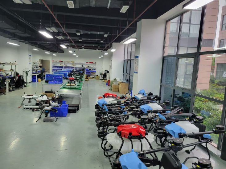
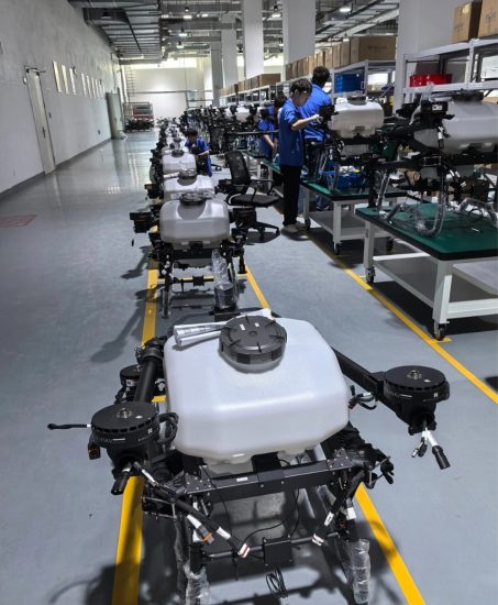
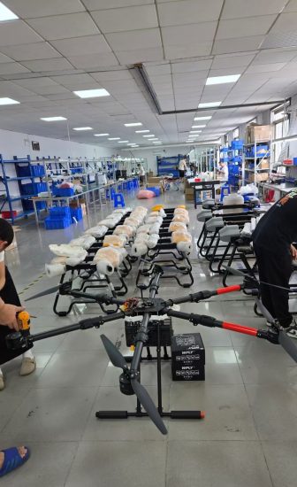
- The Drone Solution: Heavy-payload multirotors (like the DJI Agras series or ABZ Innovation systems) equipped with 20-liter to 50-liter tanks.
- Key Tech to Look For: Atomizing centrifugal nozzles for consistent droplet sizes, downward air-wash to push chemicals deep into the crop canopy, and terrain-following radar to maintain a fixed altitude above uneven landscapes.
2. Geospatial Surveying & Photogrammetry (Mapping / 3D Modeling)
- The Business Pain Point: Traditional land surveying on foot takes weeks, exposes teams to hazardous terrains (cliffs, mines), and terrestrial scanners struggle with vast spaces.
- The Drone Solution: Fixed-wing or specialized quadcopters equipped with high-megapixel mechanical shutters or LiDAR (Light Detection and Ranging) sensors.
- Key Tech to Look For: RTK (Real-Time Kinematic) positioning modules. RTK bypasses traditional ground control points, delivering centimeter-level geospatial accuracy (X, Y, Z coordinates) directly into your GIS software (like QGIS or ArcGIS) in real time.
3. Industrial Asset Operations (Powerline / Pipeline / Infrastructure Inspection)
- The Business Pain Point: Inspecting wind turbines, high-voltage power grids, solar farms, or oil pipelines requires shutting down operations, building massive scaffolding, or putting human climbers at risk.
- The Drone Solution: Rugged, weather-sealed quadcopters featuring modular dual-payload gimbals (thermal imaging + high-optical zoom).
- Key Tech to Look For: An IP45 or higher weatherproofing rating to fly in heavy rain and wind, AI-driven spot-check software to lock onto exact structural defects automatically during repeat flights, and strong anti-magnetic interference shields.
Enterprise Hardware Selection Matrix
Frequently Asked Questions (FAQ)
Q1: What is the practical difference between choosing a Fixed-Wing vs. a Multirotor drone for mapping?
A: It comes down to scale and flight endurance. Multirotor drones are excellent for smaller, complex sites (under 200 hectares) because they can take off vertically anywhere and hover precisely over tight spots. However, they run out of battery in 30–45 minutes. Fixed-wing drones fly like traditional airplanes, offering 90+ minutes of flight time. They are far more efficient for sprawling, linear mapping projects like cross-country highways, pipelines, or massive agricultural cooperatives.
Q2: Why is “RTK” considered mandatory for modern engineering and mapping workflows?
A: Standard drone GPS has an inherent margin of error of 2 to 5 meters, which is completely unacceptable for land titles or construction modeling. An RTK-enabled drone connects to a local ground base station or satellite network to constantly correct its positioning errors mid-flight, bringing the spatial data accuracy down to less than 2 centimeters. This eliminates the tedious process of laying down physical, manual markers across a site before flying.
Q3: How do industrial drones handle extreme weather, dust, and wind in harsh environments?
A: Enterprise drones are built with specific Ingress Protection (IP) ratings. For example, an IP55-rated drone features completely sealed motor housings, protected battery bays, and internal heating elements. This allows the aircraft to operate safely in heavy downpours, dusty desert mine sites, and sub-zero winter temperatures where consumer-grade electronic devices would instantly short-circuit or freeze.
Q4: We have no drone pilots on staff. Is the software easy enough for a standard technician to use?
A: Yes, modern industrial platforms are shifting heavily toward full autonomy. For mapping and spraying, pilots rarely fly with manual joysticks. Instead, you use a tablet to draw a box around your target field or asset on a digital map, set your target altitude, and hit “Execute.” The drone automatically calculates its flight lines, manages its battery lifespans, executes the mission, and returns to the exact launch pad completely hands-off.



No comments yet