
Currently, the rise in soil temperature is a key period for wheat field management and yield formation. Ningjin County, Xingtai City, Hebei Province, is a major grain producing county. The grain planting area has been maintained at around 1.9 million mu all year round, and the grain output has been stable at over 900000 tons for many years. Now, agricultural technicians in Ningjin County fully utilize scientific and technological means such as Beidou satellite, unmanned agricultural machinery, and field weather stations to help farmers manage wheat in spring, laying a solid foundation for a high yield and harvest of grain.
At present, it is the crucial stage for wheat irrigation to return to green water. Instead of using traditional flood irrigation in the field, it is an automatic self-propelled electric translational irrigation machine. The arm length of the irrigation machine is about 100 meters, and it can be used for irrigation across the wheat field. There are more than 70 sprinklers in total, and the water sprayed is very uniform, saving 60% water compared to the traditional flood irrigation method. In addition, there are new water-saving irrigation models such as shallow buried drip irrigation and deep buried drip irrigation.
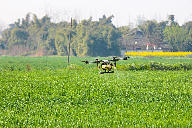
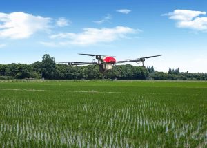
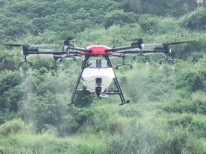
In the air of another wheat field, drones flew by from time to time. The multi spectral camera carried by the drone can monitor the wheat seedling condition, and more accurately and efficiently manage water and fertilizer integration based on the monitoring results of the seedling condition and soil moisture, achieving water and fertilizer conservation, increasing production and efficiency.
There are many meteorological facilities in the field, and the main function of the field microclimate observation station is to measure environmental parameters such as temperature, humidity, photosynthetic utilization rate, and provide data reference for field management such as fertilization and watering. The data from the observation station can be transmitted to the intelligent control center in real time. Through multispectral remote sensing and real-time monitoring at 204 detection sites throughout the county, it helps more than 100 agricultural science and technology specialists in the county make scientific decisions and accurately guide farmers’ production. These data can also be synchronized to the mobile app, where agricultural technicians and farmers can view in real time when the land should be fertilized and watered. Compared to traditional farming modes, it is more accurate and intuitive, and can be said to be a proper “field nanny.”.

Please sign in to comment
register