
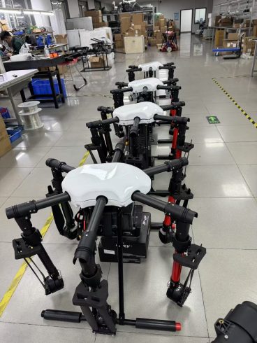
![图片[1]-Terrain Following Radar Drones: Redefining Flight in Complex Environments-msoen](https://www.msoen.com/wp-content/uploads/2025/04/4e0da2d332214638-768x1024.jpg)
In an era where drones are transforming industries from agriculture to disaster response, one critical challenge remains: navigating unpredictable, terrain-rich environments safely and efficiently. From jagged mountain ranges and dense forests to floodplains and urban canyons, traditional drones rely on GPS and basic obstacle avoidance—systems that falter when signals are blocked, terrain is uneven, or visibility is poor. Enter terrain following radar (TFR) drones: a revolutionary leap in aerial technology that combines advanced sensing, AI, and real-time data processing to enable drones to “read” the landscape and adapt their flight paths dynamically. As a leading developer of TFR-enabled drones, we’re unlocking new possibilities for industries that demand precision, safety, and reliability in the most challenging terrains.
What is Terrain Following Radar (TFR)?
Terrain following radar is a sensor system that uses radio waves to map the ground or water surface in real time, measuring elevation, slope, and surface features (e.g., vegetation, rocks, or man-made structures) with centimeter-level accuracy. Unlike GPS, which relies on satellite signals (vulnerable to blockage or interference), TFR operates independently, making it ideal for environments where GPS is unreliable or absent. Integrated into drones, TFR acts as a “digital eye,” providing the aircraft with a detailed 3D map of its surroundings to navigate, avoid obstacles, and execute precise maneuvers.
Why TFR Drones Matter: Solving Complex Terrain Challenges
- Unmatched Safety in GPS-Denied Environments
GPS signals weaken or disappear in:
- Urban canyons (tall buildings blocking signals).
- Dense forests (canopy cover attenuates satellite signals).
- Underground or indoor spaces (e.g., mines, tunnels).
- Remote regions (limited satellite coverage).
TFR drones eliminate this risk. By emitting radio waves that penetrate vegetation and bounce off terrain, they maintain positional awareness even in GPS “dead zones.” For example:
- A TFR-equipped drone mapping a mountainous forest can detect cliff edges, landslides, or fallen trees in real time, adjusting its flight path to avoid collisions.
- A rescue drone in a collapsed building uses TFR to navigate rubble, identifying stable pathways to locate survivors.
- Precision Flight for Critical Missions
Industries like agriculture, mining, and environmental monitoring require drones to fly at specific altitudes (e.g., crop spraying at 3–5 meters, geological surveys at 10–20 meters). TFR ensures:
- Consistent Altitude: The drone maintains a target height above terrain, even over rolling hills or varying elevations, avoiding over-spray (agriculture) or missed data points (surveying).
- Adaptive Path Planning: TFR data feeds into the drone’s flight controller, enabling automatic adjustments for slopes, ditches, or unexpected obstacles (e.g., a boulder in a mining survey area).
- Enhanced Data Accuracy
For applications like precision agriculture, forestry, or disaster assessment, accurate terrain data is non-negotiable. TFR drones capture:
- Surface Details: Vegetation height, water depth, or soil moisture levels—critical for calculating spray doses (agriculture) or flood risk (disaster response).
- 3D Topography: High-resolution maps of terrain features (e.g., gullies, ridges) that influence water flow, erosion, or habitat distribution. Real-World Applications: TFR Drones in Action
- Agriculture: Spraying in Hilly Terraces
In Vietnam’s Central Highlands, terraced rice fields and sloped vegetable farms pose significant challenges for traditional drones. A TFR-equipped drone from our factory:
- Problem: Manual spraying in these fields is slow (5–7 days/acre) and wasteful (30% chemical overuse due to uneven terrain).
- Solution: The TFR drone maps the terraced landscape, adjusting spray height to 3–4 meters above each terrace. AI-powered variable-rate spraying (VRS) reduces chemical usage by 45%, while TFR ensures no area is missed—even on 45° slopes.
- Result: Farmers cut costs by $12,000/year per 100-acre farm and boost yields by 18% due to precise pesticide application.
- Forestry: Monitoring Old-Growth Forests
In the Amazon rainforest, illegal logging and wildfires threaten biodiversity. A TFR drone from our partner organization:
- Problem: Traditional drones struggle to navigate dense canopies, missing small clearings or hidden fires.
- Solution: TFR detects subtle elevation changes (e.g., recently cleared areas) and identifies heat signatures from early-stage fires. The drone’s 3D terrain map pinpoints fire spread paths, enabling rapid response by ground crews.
- Result: Fire detection time decreased from 4 hours to 20 minutes, saving 1,200 acres of forest in a single season.
- Disaster Response: Post-Earthquake Reconnaissance
After the 2023 Turkey-Syria earthquake, TFR drones were deployed to assess damage in collapsed urban areas:
- Problem: Rubble and debris blocked GPS signals, making traditional drones unreliable.
- Solution: TFR mapped the terrain, identifying stable building foundations, blocked roads, and trapped survivors. The drone’s real-time data helped prioritize rescue efforts, reducing search time by 60%. Why Choose Our TFR Drones?
As a pioneer in TFR technology, we integrate cutting-edge sensors, AI, and rugged design to deliver unmatched performance:
- High-Performance TFR Sensors
Our drones use 77 GHz millimeter-wave radar—the gold standard for terrain mapping—with:
- 200-meter Range: Detects obstacles up to 200 meters ahead, even in fog or rain.
- 1 cm Accuracy: Maps terrain elevation with sub-centimeter precision.
- Low Latency: Processes data in <50 ms, enabling real-time flight adjustments.
- Rugged, Weatherproof Design
- Industrial-Grade Components: Built to withstand temperatures (-30°C to 60°C), heavy rain (IP68 rating), and dust.
- Long Endurance: Up to 90-minute flight times with a 50L payload, ideal for large-scale operations.
- Customizable Solutions
We tailor TFR drones to your industry:
- Agriculture: Optimized for low-altitude spraying (2–5 meters) with VRS systems.
- Forestry/Mining: High-altitude mapping (10–50 meters) with 3D topography software.
- Disaster Response: Emergency configurations with thermal imaging and emergency landing protocols.
- Global Support & Compliance
- Certifications: CE (EU), FCC (US), and CAAC (China) compliant.
- Local Partnerships: Multilingual technical teams provide pre-sales training, on-site repairs, and 24/7 after-sales support in 50+ countries. The Future of TFR Drones
As industries push into more extreme environments—from deep forests to Martian analog terrains—TFR technology will evolve:
- Swarm TFR Drones: Multiple drones collaborating to map large areas, sharing TFR data in real time for faster, more accurate surveys.
- AI-Enhanced Predictive Analytics: TFR data combined with weather and historical models to forecast terrain risks (e.g., landslide-prone areas).
- Fully Autonomous Operations: Drones using TFR to plan and execute entire missions without human intervention—from takeoff to landing. Your Next Step: Elevate Your Operations
Terrain following radar drones aren’t just tools—they’re game-changers for industries that demand precision, safety, and reliability in complex terrains. Whether you’re a farmer protecting crops, a forester safeguarding ecosystems, or a rescuer saving lives, our TFR drones are ready to redefine what’s possible.
Contact us today to schedule a demo, request a custom quote, or learn how our TFR drones can transform your operations.
暂无评论内容