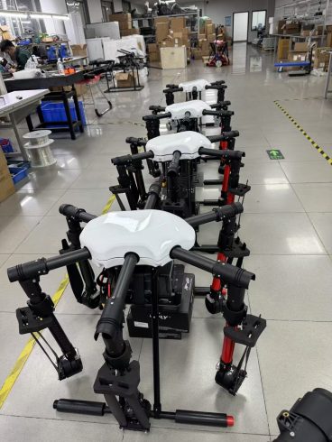
![图片[1]-How to Plan Efficient Drone Sprayer Flights: Essential Tips for Agricultural Success-msoen](https://www.msoen.com/wp-content/uploads/2025/04/0e151c96c1214759-768x1024.jpg)
Drone sprayers are revolutionizing precision agriculture, but their effectiveness hinges on meticulous flight planning. Poorly designed flight paths can lead to uneven chemical application, wasted resources, and even regulatory violations. For agricultural drone operators, optimizing flight plans is critical to maximizing yield, reducing costs, and ensuring compliance. This guide dives into actionable tips to master drone sprayer flight planning.
- Pre-Flight Ground Reconnaissance
Before launching your drone, conduct a thorough on-ground survey of your target area:
- Map Obstacles: Identify trees, power lines, buildings, or water bodies that could interfere with flight paths or spray drift.
- Assess Crop Canopy: Note variations in crop height, density, and spacing. Tall or dense crops may require adjusted altitude or nozzle settings.
- Soil and Topography: Use satellite imagery or drones to create 3D maps. Slopes exceeding 15 degrees may demand manual pilot intervention.
Pro Tip: Geo-tag permanent markers (e.g., field boundaries, access roads) to streamline software-based path generation.
- Optimize Flight Path Parameters
A. Altitude and Swath Width
- Altitude: Fly at 3–8 meters for optimal overlap (70–90%) and minimal drift. Higher altitudes increase swath width but risk uneven coverage.
- Swath Adjustment: Taller crops (e.g., corn) require wider swaths, while delicate crops (e.g., vineyards) need narrower passes. B. Route Overlap and Grid Patterns
- Parallel Passes: Use headland turns to maintain consistent overlap. For rectangular fields, grid patterns work best.
- Contour Flying: In sloped areas, align flights parallel to contours to prevent chemical runoff.
Software Tools: Leverage GIS-based platforms to generate automated paths that factor in field shape, obstacles, and nozzle capabilities.
- Weather and Environmental Considerations
- Wind Speed: Avoid flights when winds exceed 10–12 km/h, as drift can damage neighboring fields. Use anemometers for real-time monitoring.
- Temperature and Humidity: High heat increases evaporation, reducing efficacy. Schedule flights during cooler parts of the day (early morning or late afternoon).
- Precipitation: Postpone flights if rain is forecast within 6 hours, as wet foliage repels chemicals.
- Technical Settings for Precision
A. Nozzle and Flow Rate Calibration
- Nozzle Type: Select air-induction nozzles to minimize drift and ensure uniform droplet size.
- Flow Rate: Sync the drone’s spray rate with flight speed (e.g., 2 L/ha at 8 m/s). Adjust via flight control software. B. RTK GPS and Waypoint Accuracy
- Enable RTK or PPK correction for centimeter-level positioning. This avoids overlaps/underlaps caused by GPS drift.
- Manually verify waypoints near obstacles to prevent abrupt stops or erratic maneuvers. C. Battery and Power Management
- Plan flights around battery life. For example, a 30-liter payload drone with 25-minute flight time may require mid-field battery swaps.
- Use thermal sensors to monitor battery health and avoid mid-air failures.
- Compliance with Local Regulations
- No-Fly Zones: Check airspace databases (e.g., FAA UAS Facility Maps) to avoid restricted areas like airports or wildlife reserves.
- Spray Buffers: Maintain a 3–5 meter buffer near water bodies or residential zones to comply with EPA or EU regulations.
- Documentation: Log flight paths, spray logs, and chemical usage for audits.
- Post-Flight Analysis and Iteration
- Coverage Verification: Use multispectral imagery to identify untreated zones or over-application areas.
- Data Integration: Feed flight data into farm management software to refine future plans. For example, correlate spray patterns with yield maps to optimize next season’s strategy.
Key Metrics to Track:
- Chemical usage efficiency (liters/hectare).
- Overlap consistency (%).
- Drift incidents (nearby field complaints).
- Future-Proofing with AI and Automation
Emerging technologies are simplifying flight planning:
- AI-Powered Path Optimization: Algorithms analyze historical weather, soil, and crop data to auto-generate efficient routes.
- Swarm Farming: Coordinate multiple drones for large-scale operations, splitting fields into zones for simultaneous spraying.
Final Checklist for Effective Flight Planning
- Conduct ground surveys and 3D mapping.
- Adjust altitude, swath width, and overlap based on crop type.
- Validate weather and regulatory conditions.
- Calibrate nozzles and sync flow rates with flight speed.
- Enable RTK GPS and manually check waypoints.
- Plan battery swaps and emergency landing zones.
- Post-analyze data to refine future flights.
Conclusion
Mastering drone sprayer flight planning transforms agricultural operations from reactive to proactive. By combining technical precision, environmental awareness, and data-driven iteration, farmers can achieve uniform coverage, reduce chemical waste, and comply with global regulations. As AI and swarm technologies evolve, flight planning will become even more efficient—ushering in an era of fully automated, results-oriented farming.
Key Takeaways:
- Start with ground reconnaissance and 3D mapping.
- Optimize altitude, overlap, and nozzle settings for crop type.
- Integrate real-time weather data and regulatory checks.
- Use post-flight analytics to refine future strategies.
Efficient flight planning isn’t just a skill—it’s the foundation of profitable, sustainable agriculture in the drone age.



暂无评论内容