
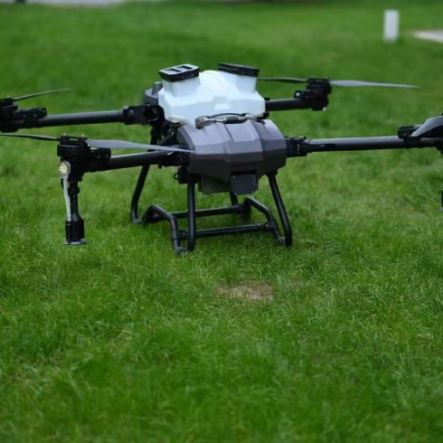
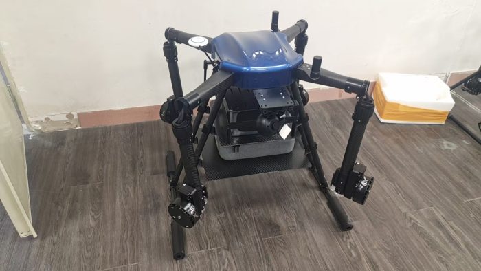
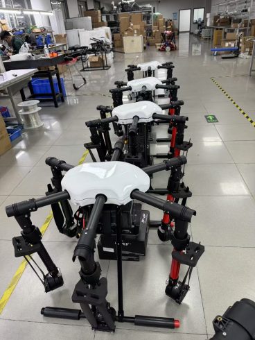
![图片[1]-Agricultural Drones with Obstacle Radar: Redefining Safe, Efficient Crop Protection in Complex Terrains-msoen](https://www.msoen.com/wp-content/uploads/2025/04/3ea0601715184639-1024x768.jpg)
In the era of precision agriculture, where drones have become indispensable for tasks like spraying, mapping, and monitoring, one critical challenge persists: navigating complex, obstacle-rich environments safely and efficiently. From dense orchards and sloped farmlands to forested edges and irrigation ditches, traditional drones often struggle with obstacles—leading to collisions, crop damage, or even dangerous crashes. Enter agricultural drones with obstacle radar: a game-changing innovation that merges cutting-edge sensing technology with AI-driven autonomy to transform how farmers protect their crops.
The Challenge: Why Traditional Drones Struggle in Complex Terrains
Agricultural operations often take place in environments riddled with natural and man-made obstacles:
- Vegetation: Tall crops (e.g., corn, sugarcane), vines, or orchard canopies block GPS signals and create “blind spots.”
- Terrain: Slopes, ditches, and uneven fields disrupt flight paths, forcing manual adjustments.
- Man-Made Hazards: Power lines, fences, barns, or irrigation equipment pose collision risks.
- Weather: Wind, rain, or fog degrade visibility, making manual piloting error-prone.
For farmers, these challenges mean:
- Increased Risk: Collisions damage drones and crops, leading to costly repairs and yield losses.
- Reduced Efficiency: Frequent manual interventions slow operations, extending spraying or monitoring cycles.
- Limited Accessibility: Complex terrains restrict drone use, leaving critical areas (e.g., dense groves) unprotected. How Obstacle Radar Transforms Agricultural Drones
Obstacle radar—short for obstacle detection and avoidance radar—is a sensor system that uses radio waves to detect and map obstacles in real time. Integrated into agricultural drones, it addresses the above challenges by:
- All-Weather, All-Day Sensing
Unlike cameras or LiDAR (which struggle in fog, rain, or darkness), radar operates in all weather conditions. It emits radio waves that penetrate vegetation and light obscurants, providing 360° coverage of the drone’s surroundings. This ensures safe operation even in:
- Dense fog or heavy rain.
- Low-light conditions (e.g., early mornings or late evenings).
- Canopied areas (e.g., orchards, vineyards) where GPS signals are weak.
- High-Precision Obstacle Detection
Modern obstacle radars for agriculture are engineered with:
- Wide Bandwidth: Detects obstacles as small as 10 cm (e.g., irrigation pipes, fence posts) at distances up to 200 meters.
- High Resolution: Maps obstacle shapes and trajectories, distinguishing between static objects (e.g., barns) and dynamic ones (e.g., moving livestock).
- Low Latency: Processes data in milliseconds, enabling real-time adjustments to flight paths.
- AI-Powered Autonomous Navigation
Obstacle radar works hand-in-hand with AI algorithms to:
- Predict Paths: Anticipate collision risks by analyzing obstacle movement (e.g., swaying crops, moving equipment).
- Optimize Trajectories: Calculate the safest, most efficient route around obstacles, minimizing detours and maximizing coverage.
- Learn from Data: Over time, the system improves its obstacle-avoidance logic by analyzing past flights, adapting to unique farm layouts (e.g., sloped fields, recurring equipment placements). Real-World Applications: How Obstacle Radar Drones Are Transforming Agriculture
- Orchards & Vineyards: Navigating Dense Canopies
Orchards and vineyards are prime examples of obstacle-rich environments. Traditional drones risk colliding with branches or getting stuck in dense foliage. With obstacle radar:
- Example: A vineyard in France uses radar-equipped drones to spray pesticides. The radar detects low-hanging grapevines and power lines, automatically adjusting altitude and path to avoid damage—reducing crop loss by 30% and repair costs by 40%.
- Sloped Farmlands: Staying Stable on Uneven Terrain
Slopes and terraces are hazardous for drones, as uneven surfaces can cause unstable flight or crashes. Obstacle radar enables:
- Example: A coffee plantation in Brazil deploys radar drones to monitor and spray coffee plants on steep hillsides. The radar detects trench edges and loose soil, guiding the drone along safe, pre-plotted routes—maintaining consistent spray coverage and avoiding soil erosion.
- Forest Edges & Wildlife Reserves: Coexisting with Nature
Near forests or wildlife areas, drones must avoid trees, bird nests, or protected habitats. Obstacle radar:
- Example: A cotton farm bordering a nature reserve in India uses radar drones to spray pesticides. The system detects tree canopies and bird activity, rerouting the drone to avoid disturbing wildlife—preserving biodiversity while protecting crops.
- Disaster Response: Safely Assessing Damage
Post-disaster (e.g., floods, wildfires), drones are critical for assessing crop damage. Obstacle radar allows them to:
- Example: After a flood in Vietnam, radar-equipped drones surveyed submerged rice fields, avoiding submerged debris and damaged infrastructure to map affected areas—enabling faster insurance claims and recovery planning. Why Choose a Radar-Equipped Agricultural Drone from Our Factory?
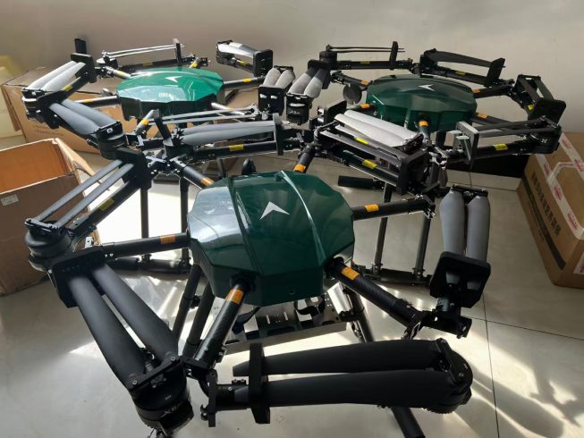
As a leading Chinese manufacturer of agricultural drones, we integrate obstacle radar with farmer-centric design to deliver unmatched performance:
- Robust, Weatherproof Hardware
- Industrial-Grade Radar: Our sensors are tested to withstand extreme temperatures (-25°C to 50°C), heavy rain, and dust—ensuring reliability in any farming environment.
- Lightweight Design: Radar modules are integrated without adding significant weight, preserving flight endurance (up to 90 minutes for our 50L model).
- Customizable Solutions
- Payload Options: Choose from 10L–100L spray tanks, with radar systems tailored to your farm’s obstacle density (e.g., dense orchards vs. open fields).
- Software Integration: Our drones pair with user-friendly apps for mission planning, obstacle mapping, and real-time monitoring—no pilot’s license required.
- Global Compliance & Support
- Certifications: Our drones meet CE (EU), FCC (US), and CAAC (China) standards, ensuring legal operation worldwide.
- Local Service: Multilingual technical teams provide pre-sales training, on-site repairs, and 24/7 after-sales support in key agricultural regions (Americas, Europe, Asia-Pacific). The Future of Agricultural Drones with Obstacle Radar
As agriculture becomes more complex—driven by climate change, labor shortages, and sustainability demands—obstacle radar will play a pivotal role. Future advancements include:
- Swarm Technology: Multiple radar-equipped drones collaborating to cover large fields, sharing obstacle data in real time.
- Predictive Analytics: AI models using historical obstacle data to pre-plan optimal routes for recurring tasks (e.g., seasonal spraying).
- Fully Autonomous Farms: Drones working alongside robots and IoT sensors to create closed-loop systems, where every action (spraying, harvesting) is optimized by obstacle-aware data. Your Next Step: Elevate Your Farming Operations
An agricultural drone with obstacle radar isn’t just a tool—it’s a partner that safeguards crops, reduces risks, and unlocks efficiency in even the most challenging environments. Whether you manage 100 acres or 100,000, our radar-equipped drones are ready to redefine what’s possible for your farm.
Contact us today to schedule a demo, request a custom quote, or learn how our obstacle radar drones can transform your agricultural operations.

暂无评论内容